General Discussion
Related: Editorials & Other Articles, Issue Forums, Alliance Forums, Region ForumsKeeping the people of the Philippines in our thoughts......
Super typhoon Haiyan closes in on Philippines, among strongest storms ever
By Jason Samenow and Brian McNoldy
November 7 at 11:58 am

The Joint Typhoon Warning Center has increased its estimate of Haiyan’s maximum sustained winds to 195 mph with gusts to 235 mph. The storm is now within a few hours of landfall in the central Philippines at peak intensity as among the most powerful storms witnessed anywhere in modern times. Widespread destruction, unfortunately, seems inevitable. ...................(more)
The complete piece is at: http://www.washingtonpost.com/blogs/capital-weather-gang/wp/2013/11/07/super-typhoon-haiyan-closes-in-on-philippines-among-strongest-storms-ever/?tid=pm_pop
 = new reply since forum marked as read
Highlight:
NoneDon't highlight anything
5 newestHighlight 5 most recent replies
= new reply since forum marked as read
Highlight:
NoneDon't highlight anything
5 newestHighlight 5 most recent replies

enlightenment
(8,830 posts)with sustained winds of 195 mph, so the strongest on record. Tacloban City is already reporting severe damage and flooding; Jeff Masters says they lost contact with the city of Guiuan, where it first hit.
http://www.wunderground.com/blog/JeffMasters/comment.html?entrynum=2573
This is awful.

marmar
(77,056 posts)
enlightenment
(8,830 posts)At least people can still do that (tweet) for now - but I am certain that the loss of life is going to be extreme. So many people in the islands, with no where to go.
Someone posted this on instagram about an hour ago; it had hardly begun at that point.
http://instagram.com/p/gbow7rKWz7/#
seabeyond
(110,159 posts)enlightenment
(8,830 posts)Debris floating down the street.
seabeyond
(110,159 posts)enlightenment
(8,830 posts)
Rstrstx
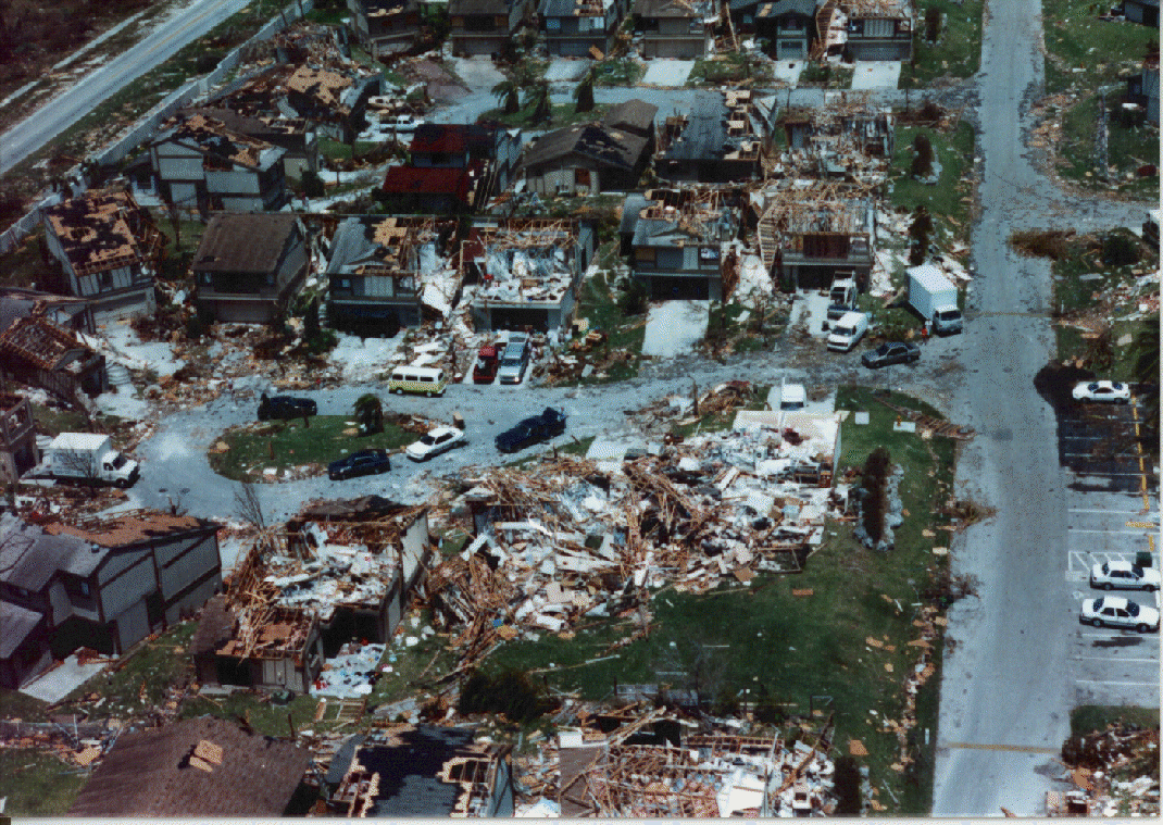
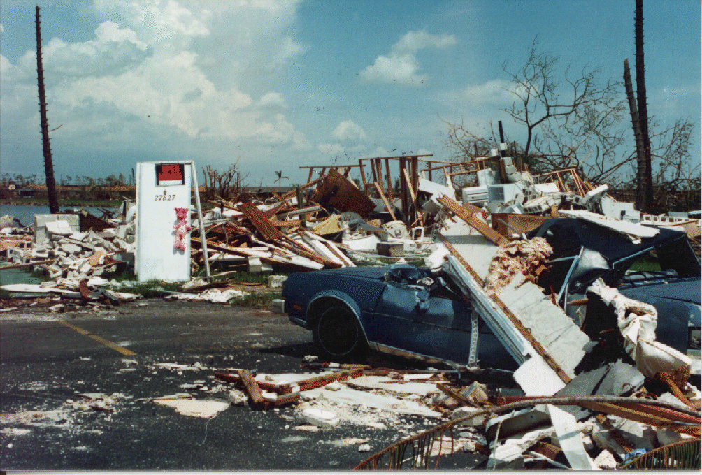
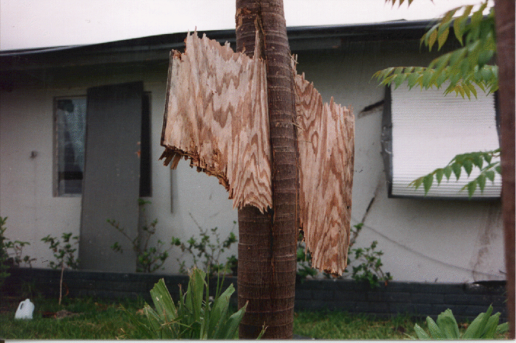
(1,399 posts)Those look about like 130-140mph winds give or take a few mph. At 195mph you're basically stuck in a strong F3 tornado, enough to turn over trains, pick up cars and destroy frame homes. Gusts to 235 can throw cars through the air like toys. There will probably be very little standing in the zone where winds were over 175mph. Tidal surge doesn't look to be THAT high, about 12-17 ft, less than Katrina. Though I hear parts of where the storm hit are less than 10' about sea level, not good.
For an example, look at the damage from Andrew '92, which had peak winds of about 40mph LESS at landfall (and remember, the higher the winds go the damage increases exponentially, 10mph over 160 is much worse than 10mph over 100).
Damage from this typhoon is unfortunately going to be at least an order of magnitude worse than Andrew, that building standing in the last picture would have a high probability of failure at 195. Photos from NHC
seabeyond
(110,159 posts)
malaise
(268,724 posts)I'm terrified for them - and there was another major storm last year.
Stay safe folks 

Joanie Baloney
(1,357 posts)I couldn't get over the other satellite photo of Earth showing the perfect doughnut hole as indicated by the weather shot above. It looks like the finishing spot where they sealed up a basketball.
Stay safe, fellow Earthlings!
-JB

dixiegrrrrl
(60,010 posts)Folks around the Gulf of Mexico get pretty experienced at seeing hurricane pictures...this one is frighteningly classic.

TeeYiYi
(8,028 posts)Proof that a picture is worth a thousand words. 
TYY

Bosonic
(3,746 posts)The storm hasn't hit him yet, but I think he is within its path...
http://www.ustream.tv/channel/magic-rich

sheshe2
(83,667 posts)yet they are in my thoughts and prayers.

Little Star
(17,055 posts)Stay safe people of the Philippines.
Electric Monk
(13,869 posts)
adirondacker
(2,921 posts)By: Dr. Jeff Masters, 10:58 PM GMT on November 07, 2013 +40
Super Typhoon Haiyan has made landfall. According to PAGASA, Haiyan came ashore at 4 am local time (20 UTC) November 7, 2013 near Guiuan, on the Philippine island of Samar. At the time, Guiuan reported sustained 10-minute average winds of 96 mph, with a pressure of 977 mb. Contact has since been lost with the city. Two hours before landfall, the Joint Typhoon Warning Center assessed Haiyan’s sustained winds at 195 mph, gusting to 235 mph, making it the 4th strongest tropical cyclone in world history. Satellite loops show that Haiyan weakened only slightly, if at all, in the two hours after JTWC’s advisory, so the super typhoon likely made landfall with winds near 195 mph. This makes Haiyan the strongest tropical cyclone on record to make landfall in world history. The previous record was held by the Atlantic's Hurricane Camille of 1969, which made landfall in Mississippi with 190 mph winds.
http://www.wunderground.com/blog/JeffMasters/comment.html?entrynum=2573
These poor folks.
AverageJoe90
(10,745 posts)Damn, I feel terrible for the Phillipines right now. Hope all of our DU friends can stay safe over there.....

liberal from boston
(856 posts)My prayers and thoughts are with the people of the Philippines!!!
 & Rec !!!

riverwalker
(8,694 posts)

flying rabbit
(4,628 posts) Arugula Latte
(50,566 posts) 
bearssoapbox
(1,408 posts)As if they didn't have enough problems.
riverwalker
(8,694 posts)The storm (known as Yolanda in the Philippines) has officially maxed out the Dvorak scale, which is used to measure strong strength using satellites. That means Haiyan has approached the theoretical maximum intensity for any storm, anywhere. From the latest NOAA bulletin:
DVORAK TECHNIQUE MAKES NO ALLOWANCE FOR AN EYE EMBEDDED SO DEEPLY IN CLOUD TOPS AS COLD [AS THIS]
 ?w=720&h=480
NJCher
(35,622 posts)I'm thinking of a funny tech service rep who helped me a few weeks ago. He not only fixed my computer, he did it while switching from accent to accent (Australian to British, for example).
I'm gonna' call when the storm is over and see if he's still there, but having lived through Sandy, I wouldn't be too surprised if tech service for Lenovo is out of commish for awhile.

Cher
Liberal_in_LA
(44,397 posts)Uncle Joe
(58,300 posts)Thanks for the thread, marmar.