California
Related: About this forumWow Rain Today in the Bay Area...
Ya know, We hardly get rain any more...I think we are turning into a kind of desert area..
ForeCast today :

Small Craft Advisory for San Pablo Bay, Suisun Bay, the West Delta and the San Francisco Bay north of the Bay Bridge
Synopsis for the central california coast and bays including the Monterey bay..Greater farallones...and cordell bank national marine sanctuaries... Generally light winds will continue over the coastal waters through much of the week. Expect locally breezy afternoon and evening winds south of pigeon point and over the bays. A cold front will move through the waters today bringing showers. Mixed seas will persist with a moderate period northwest swell and a light southerly swell.
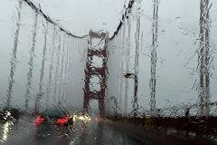
break out those Raincoats Bay Area!
As of 3:00 am pdt Monday... It's been a warm and
humid night across the region ahead of the incoming cold front. At
2 am temperatures were holding mostly in the mid to upper 60s,
while dewpoints were mostly in the lower 60s. Increasing low level
moisture ahead of the approaching front has been sufficient to
generate areas of drizzle overnight, enough to accumulate up to a
few hundredths in portions of western san mateo county and in the
east bay hills.
The incoming cold front continues to look quite impressive on
satellite, at least for this time of year. Kmux radar shows the
frontal rain band is just beginning to push into northwest sonoma
county. The latest NAM and hrrr models indicate that enhancement
will occur along the frontal boundary as it pushes south through
the sf bay area this morning. Both models generate the highest
rain totals south of the golden gate later this morning with the
hrrr forecasting isolated half inch rain totals in the santa cruz
mountains and east bay hills. Similarly, the nam's highest totals,
about a third of an inch, are in the east bay hills. Both models
indicate highly variable qpf, with some areas not expected to see
any measurable rain, while others accumulate more then their
september average precipitation. This high degree of variability
may indicate the presence of convective elements within the
frontal boundary as it moves through. Lightning strikes are
currently being detected farther north along the front, across
trinity, shasta, and siskiyou counties. The models forecast a fair
amount of instability along the front at our latitude, but the
most unstable air is projected to remain to our north and east,
and this is where the storm prediction center indicates
thunderstorm potential. If isolated thunderstorms were to develop
in our area today, it would most likely be across eastern portions
of the east bay later this morning. However, forecast confidence
for thunderstorm development is not high enough to add chances to
the forecast.
The front is forecast to reach the monterey bay area by midday and
perhaps produce a little light rain as far south as the big sur
coast by early afternoon. Precipitation is expected to end in all
areas by mid afternoon.
Tuesday is shaping up to be a sunny and mild day in between
weather systems. The next system, currently located in the gulf of
alaska, is forecast to drop southeast and into northern california
by late Tuesday night and Wednesday. Models generally agree that a
few showers may make it as far south as the north bay on
Wednesday. However, this system's trajectory is forecast to be
farther to the east then the current system, and thus less likely
to produce rainfall in our area. As this midweek system moves into
the great basin Wednesday night, we may see some locally gusty
northerly winds in our hills late Wednesday night into Thursday.
The Wednesday system will also bring a reinforcing shot of cool
air into our region and keep inland temperatures on the cool side
of normal through Thursday.
The GFS and ECMWF ensemble mean both indicate warmer and drier
conditions on Friday and Saturday as a ridge develops over
california, with temperatures warming at least a few degrees above
normal. A trough moving inland to our north on Sunday will then
likely cool temps modestly on Sunday.
more...
https://l-36.com/weather.php?lat=37.81&lon=-122.44&point1=San+Francisco,+CA&point2=Marine+Location+Near+San+Francisco,+CA&tide1=San+Francisco,+California&tide2=Alcatraz+Island+S,+San+Francisco+Bay,+California+Current&lat_long1=37.81,-122.44&radar=MUX&radar2=DAX&station=mtr&ports=9414290&rss=ftpc1&rss2=omhc1&rss3=tibc1&airport=KSFO&geos=west/wc&lat_long2=37.81,-122.44&yd10=on&zone1=PZZ530&zone2=PZZ500&v=0.50&where=San+Francisco,+CA
 = new reply since forum marked as read
Highlight:
NoneDon't highlight anything
5 newestHighlight 5 most recent replies
= new reply since forum marked as read
Highlight:
NoneDon't highlight anything
5 newestHighlight 5 most recent replies

Iliyah
(25,111 posts)
yuiyoshida
(41,818 posts)


Auggie
(31,133 posts)nice to wake up to. Fingers crossed that lightning strikes don't cause any problems.