Virginia has a subway-style Amtrak map
Hat tip: a listserv for train enthusiasts in northern Virginia.
Virginia has a subway-style Amtrak map
TRANSIT By Dan Malouff (Editorial Director) May 2, 2018
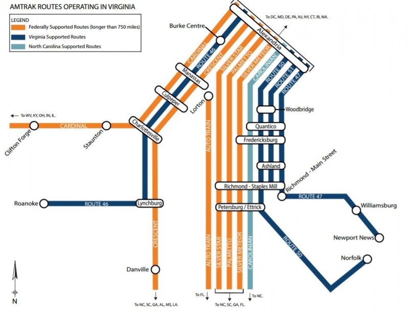
Virginia's Department of Rail and Public Transportation (DRPT) created this handy subway-style map of all 11 Amtrak lines in the state. It's simple, but it usefully illustrates where you can get on intercity trains in Virginia.
The maps divides Virginia's 11 lines into three categories: Orange for national long-haul trains that happen to pass through Virginia, blue for spurs of the Northeast Corridor that Virginia specifically pays to operate, and teal for a train that North Carolina pays to pass through. VRE trains aren't shown.
The route numbers on the Northeast Corridor spur trains are Amtrak designations. Every Amtrak route has a number, just like a bus route, but usually they're not shown to the public. DRPT must have included them here rather than labeling all four lines as the "Northeast Corridor."
....