Welcome to DU! The truly grassroots left-of-center political community where regular people, not algorithms, drive the discussions and set the standards. Join the community: Create a free account Support DU (and get rid of ads!): Become a Star Member Latest Breaking News General Discussion The DU Lounge All Forums Issue Forums Culture Forums Alliance Forums Region Forums Support Forums Help & Search
hatrack

(59,583 posts)
Thu Aug 16, 2012, 10:07 PM Aug 2012

NASA - Parry Channel Open 30 July 2012; Median Coverage For Date 1980-2010 79%

A satellite image released by NASA last week shows a key channel that forms part of the Northwest Passage is partially free of ice.

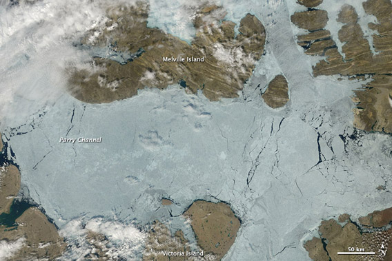
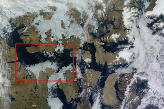
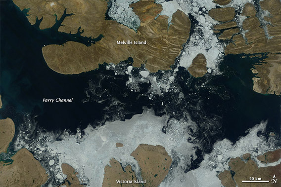
The image, acquired by the Moderate Resolution Imaging Spectroradiometer (MODIS) on NASA’s Terra satellite, shows that more than two-thirds of the Parry Channel was ice-free on July 30. The median coverage for that date was 79 percent from 1980-2010. The Parry Channel separates Victoria Island from Melville Island in Canada's far north.

Parry Channel is part of the northern route through the Northwest Passage. When navigable, the Northwest Passage offers a shortcut between the Atlantic and Pacific Oceans.


Image acquired August 3, 2012


Image acquired July 17, 2012.


The top image shows Parry Channel on August 3, when some ice was still clinging to the shores of Victoria and Melville Islands but open water otherwise dominated the region. The second image shows Parry Channel on July 17, 2012, when ice filled the channel. NASA Earth Observatory images by Jesse Allen, using data from the Land Atmosphere Near real-time Capability for EOS (LANCE)

EDIT

http://news.mongabay.com/2012/0815-nasa-nwpassage.html

Latest Discussions»Issue Forums»Environment & Energy»NASA - Parry Channel Open...