WorldView-3: Super Satellites Most Crucial Tech Stays On The Ground
http://breakingdefense.com/2014/08/worldview-3-super-satellites-most-crucial-tech-stays-on-the-ground/
WorldView-3: Super Satellite’s Most Crucial Tech Stays On The Ground
By Sydney J. Freedberg Jr. on August 12, 2014 at 5:38 PM
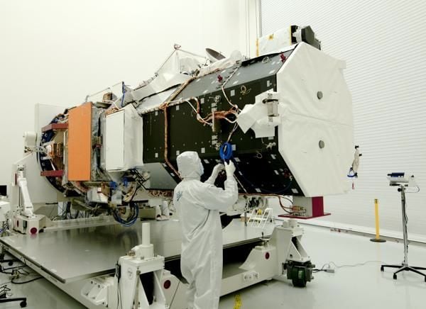
When DigitalGlobe’s WorldView-3 satellite soars skyward tomorrow – weather permitting – most attention will naturally be on the parts that go up. But the bus-sized imagery collection satellite is just the high-tech tip of an iceberg, some of whose most interesting and critical capabilities reside on the ground. DigitalGlobe is increasingly not just a space company, but an information technology company.
That’s not to say the launch itself is anything less than rocket science. There’s a 15-minute window every day to get the right trajectory, and as of the latest forecast there’s a 60 percent chance the weather won’t be clear tomorrow. And while the Boeing-Lockheed United Launch Alliance can boast 69 successful launches in a row – its great selling point over untried rival SpaceX – there’s always the chance that something could break down or blow up. But Atlas V rocket that ULA will use for WorldView-3 is an upgraded version of America’s first successful ICBM and has seen service since 1957. ULA owes its success record less to new rocket technology than to ever more careful tracking of pre-launch data from every component for any sign of problems – which is largely a data gathering and analysis problem.
Likewise, it’s data gathering and analysis that are central to DigitalGlobe’s business, and while the satellites gather – WorldView-3 will offer 30-centimeter resolution, unprecedented in the civilian world, enough to make out individual manholes – the analysis largely happens on the ground. Without that step, a better satellite just allows you to drown the client in greater amounts of meaningless raw data: DigitalGlobe’s entire constellation can image an area half the size of the continental US – four million square kilometers – every day.
WorldView-3 alone can scan a band from Washington, DC to New York City in 45 seconds. It will look at every spot on the map through 28 different “bands,” from straightforward black-and-white to color to infrared to a band specifically designed to see through cirrus clouds. In fact, the point of having all these bands is to allow computers to sort all the different types of imagery, filter out obscuring factors like clouds or snow, correct the colors for atmospheric and lighting conditions so the same car (for example) looks the same in every shot regardless of when it was taken, and produce intelligible images of what the customer wants.