regnaD kciN
regnaD kciN's JournalWater Falling Over Things 2014: Part V (May's Grand Finale)
In the Pacific Northwest, the last week of May is the traditional end of "waterfall season," at least for the lowlands, as the heavy rains that guarantee roaring falls become a thing of the past. Therefore, I wanted to "go out with a bang," and decided, since the forecast for north-central Oregon was for solid cloud cover (as I would soon be reminded yet again, forecasts do not always correspond to reality), to spend Memorial Day at a favorite for Northwest waterfall-lovers, Silver Falls State Park, a place featuring ten waterfalls, and one I had only previously visited in autumn.
As it turns out, not one of my better ideas.
You see, while the falls were running full, so were the parking lots, as practically half the population of Portland, not to mention Eugene and Salem, were apparently out communing with nature by mugging for innumerable cameraphone snapshots while standing under waterfalls, clad in either white sweats or the gaudiest-possible neon Aeropostale t-shirts. And, yes, I said under waterfalls, as most of the falls in the park feature trails cut behind the fall itself, guaranteeing Disneyland-like lines behind most of the photographic attractions of the park. Between the tourists and the not-exactly-as-forecast partly-sunny conditions we wound up with, finding a point with clouds-and-no-crowds became a quest for the sort of "critical moment" Henri Cartier-Bresson never imagined.
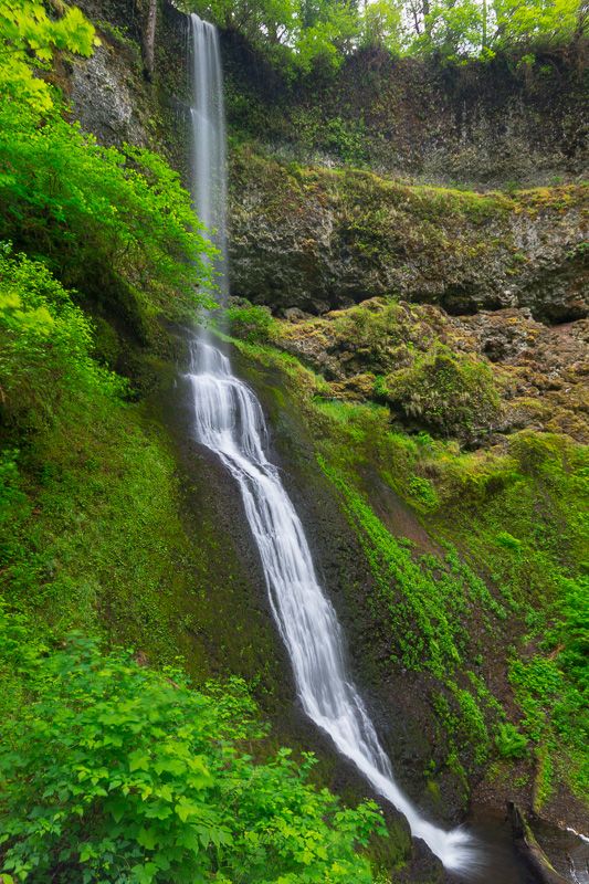
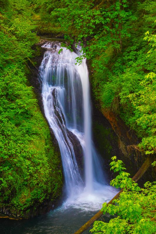
The expedition began auspiciously enough at Winter Falls. As you can no doubt tell from the name, this fall is truly impressive during the winter rainy season; while it was less-so now, it was certainly remained imposing, if a bit problematic photographically, as the only angles available are from the side, looking up at a patch of bright sky.
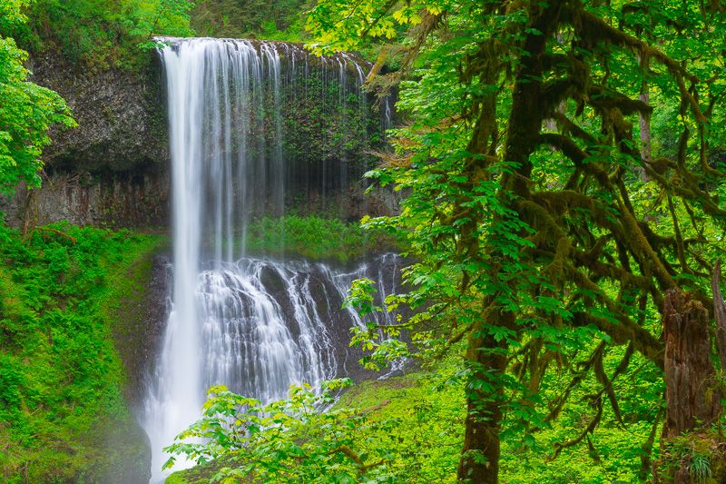
About a mile down the trail, I got to Middle North Falls, considered one of the photographic highlights of the park. While it certainly was that, it was also the spot where I began to realize the scope of my challenge here, as tourists tended to not only go behind the falls but, once there, settle in for several minute's worth of basking in the experience, taking their own pictures with point'n'shoots (using the obligatory camera flash to light up several acres of foreground, of course), modeling for family members in flexing-muscle or "I'm King of the World!" poses, etc., etc. And, when they finally opted to move on, so did the clouds, and the scene would be bathed in ugly, high-contrast sunlight. As a result, I took far longer than planned standing there at the viewpoint, waiting less-than-patiently for people to leave and clouds to arrive. Finally, a few moments' respite provided me with the chance I needed.
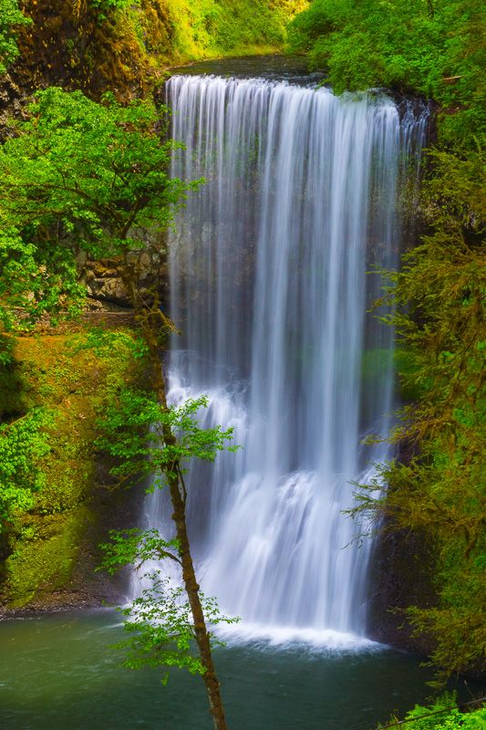
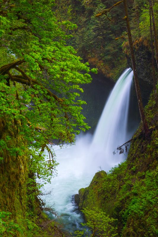
My next stop was South Falls, the tallest fall in the park, and here the problems of visiting on Memorial Day really hit home, as this fall is not only the most popular, but the most-accessible from the main parking area. How bad was it? Take a look.
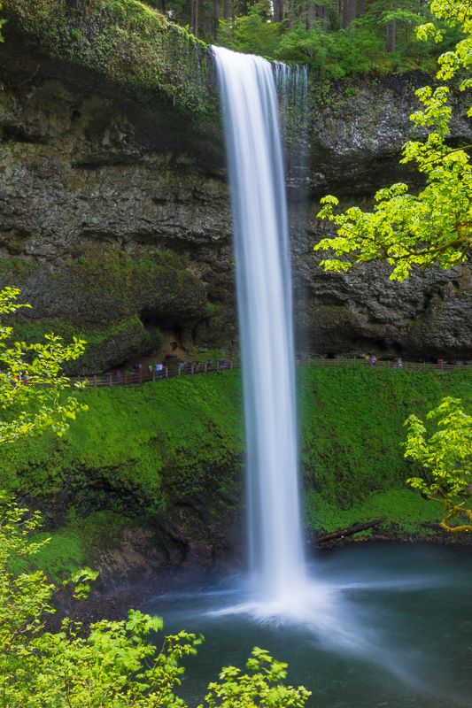
For the record, there are at least twenty-seven people standing under the falls in this otherwise-nice shot. And, when you combine them with the irregular wooden fence on the trail and some other features of the underside of the fall, it's clear that there's no way to Photoshop the crowd out of the image. And this wasn't even the most extreme -- in an image taken a few minutes after this one, I count at least forty-three tourists clumping under the waterfall.
Leaving South Falls for the moment, I headed down the trail another mile to Lower South Falls, hoping that the distance would mean fewer people. As it turned out, I was only part-way correct, as there was a line down to the falls that would rival anything this side of the Magic Kingdom. Fortunately, these people were more interested in looking at the falls from the front than spending time under them so, once I realized that what would normally be the best viewpoint for photos would give me a steady line of tourists' upper torsos in the frame, I decided to stay higher up the trail, where any such visitors could be cropped out of the frame.
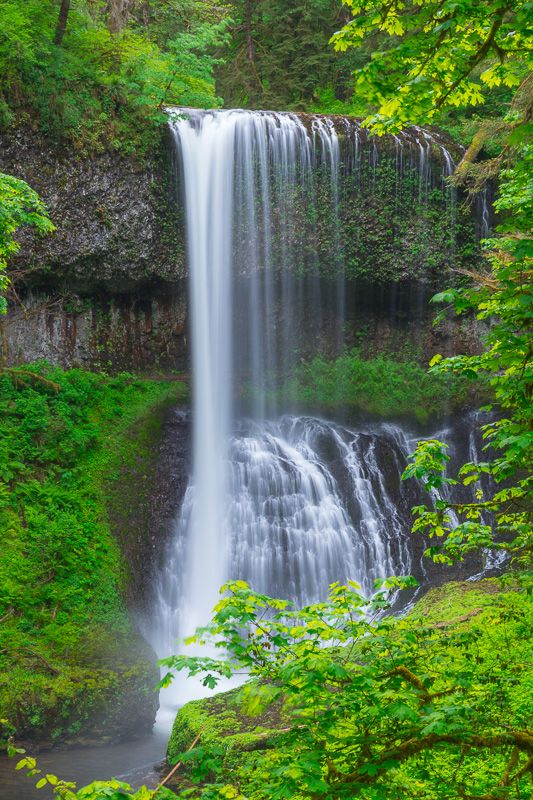
Returning to South Falls, I found that the crowd behind the waterfall had abated only slightly, and those remaining had apparently decided to compensate for it by spending even more time underneath the waters. What to do? Well, the only option was to, literally, "go over their heads"; to zoom in for a mid-detail shot of the top of the fall, cutting out the Madd(en)ing Crowd. Fortunately, I was able to come up with a very satisfying composition.
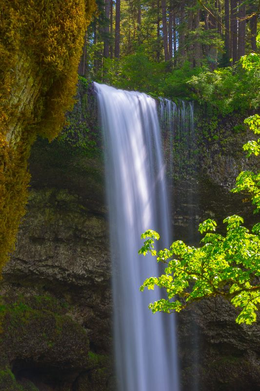
When I last visited the park in autumn, one of my favorite images came from Upper North Falls, and I was eager to see what it would look like in spring coloring. Unfortunately, I found that, since my last visit, several fallen trees had blocked-up the falls, making them significantly less photogenic. Also, at this point, the clouds began to dissipate, leaving me dealing with harsh sunlight. This was not so much of a problem at Upper North Falls, due to the falls themselves being partly shadowed by the canyon wall.
However, when I arrived at North Falls, the problem was obvious: the falls were in direct sunlight, making proper slow shutter-speeds impossible. Given that I had already taken a number of good autumn shots there, and that North Falls, more than any other, was dependent on fall foliage for maximum effect, I decided to content myself with a "record shot" of my sixth waterfall at the park.
I may have been done with WFOTourists, but it was scarcely the end of my day. I decided to head north into the Santiam State Forest, to the trail at Butte Creek, site of two supposedly quite photogenic falls, whose valley placement would allow them natural shade from late-afternoon sunlight. After the last frustrating stops at Silver Falls, I was determined to close out the day with a satisfying waterfall photo or two, or die trying.
As it turned out, I almost wound up doing both.
To quote from Gregory A. Plumb's Waterfall Lover's Guide - Pacific Northwest, the directions to Butte Creek are as follows: "From the turn for the all-terrain vehicle area (described earlier), continue 0.5 mile, then turn left onto another gravel road (not signed). Travel 2 miles down this route to a turnout to the left. A sign now exists at the trailhead." I had read that the "gravel road" in question, Forest Service Road 400, had been closed to the public for most of the spring due to logging, and had just been reopened two days before. What I did not know was that the first mile's worth of the road had been completely clear-cut, and, with the slope denuded of trees, what I was faced with was a steep, narrow, slippery gravel road with about a quarter-mile plunge off one side, and an almost-ninety-degree bend partway down, where any sliding on the loose gravel could send one skidding right off the edge...not that it was much more secure the remainder of the descent. Needless to say, there was no guardrail, nor any place to turn around safely, so that, even if you thought better of it once you saw the drop, you had no alternative but to continue all the way down and then be faced with ascending the same road. This might have been no big deal with a 4WD, but, in my passenger car, it was one of the most white-knuckle drives I've ever experienced, and one I would not recommend to others. Eventually, I made it past the clear-cut area and into the forest, where the trailhead was as free of tourists (I only encountered one other family of hikers) as Silver Falls had been full of them.
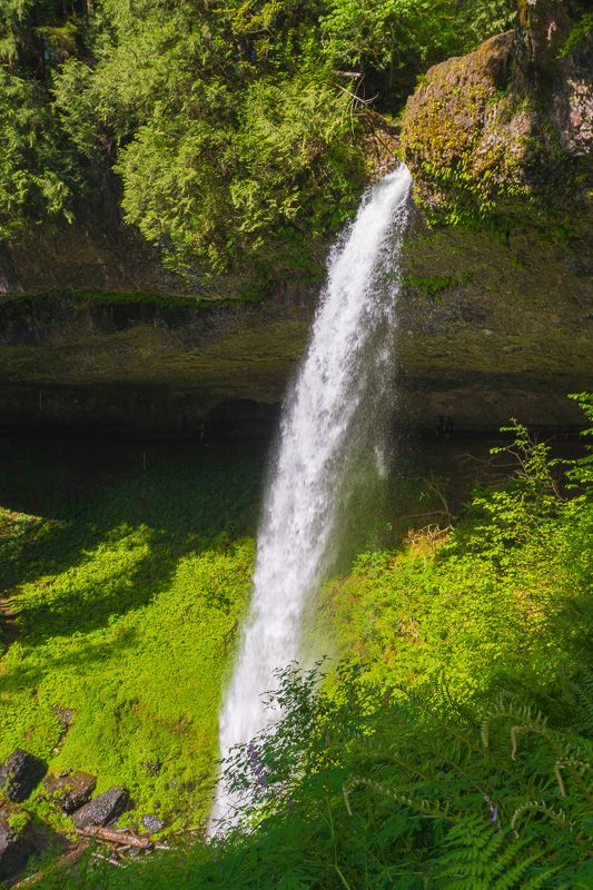
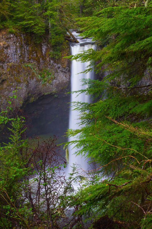
An additional surprise was in store at Butte Creek Falls. Plumb's guide at least specifies that "The viewpoints are beautiful, as they are from the top of unguarded rock outcrops." with an added "Be careful." Having dealt with unguarded outcrops many times before, I was unfazed by the description, until I got there and realized that said outcrop was really a rough ledge, about eight feet wide, sticking out into the canyon for thirty or forty feet, with a hundred-and-fifty-foot drop on either side. I'm just glad I chose to bring my trekking poles along on this trail as, without the additional support, I would have opted to turn back at this point. However, with the poles, I was able to gingerly maneuver myself to the end of the ledge where I had a clear view of the falls.
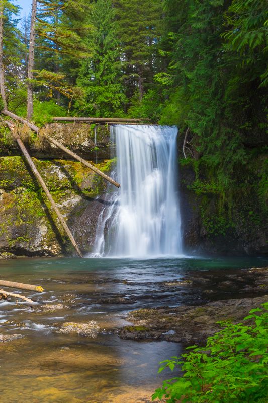
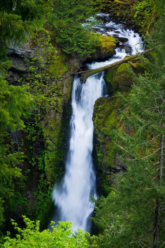
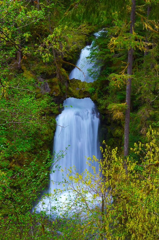
Fortunately, the route to the second fall, Upper Butte Creek Falls, was somewhat less-"interesting," and a shaft of sunlight broke through the forest above the falls at just the right moment.
Then it was another white-knuckle trip back up F.S. Road 400 (with the sun in my eyes in the crucial section this time). Needless to say, I breathed a big sigh of relief when I got to the top of the clear-cut and returned to normal roads for the four-hour drive home.
While I'm certainly not done with WFOT for the year, this marks the end of high season until autumn. I think it safe to say I got my money's worth!
Water Falling Over Things 2014: Part III ("Eagle Creek keeps fallin' on my head...")
Saturday marked my first attempt at Eagle Creek Trail in the Columbia River Gorge. My goal was to shoot two prominent waterfalls: Metlako Falls and Punch Bowl Falls. I must admit I was a bit apprehensive; I've been wanting to do this hike for years, but was never sure of whether I'd be able to handle the difficulty level. On the one hand, most people ranked it as "easy"; on the other, portions of the trail were literally blasted into the cliff, and I'd heard horror stories of passages where you had to traverse stretches of a narrow rock trail with a cliff-face on one side and a several-hundred-foot drop on the other. So, was it going to be easy or difficult?
As it turned out, the answer was "a little of both." The grade, although undoubtedly challenging to me when I first started doing serious photography several years ago, was pretty easy in my current condition. And the rock-ledge stretches were not dangerous for anyone with trekking poles, plus there was a cable "handrail" mounted on the cliff to provide further security (although I would still caution anyone with any degree of acrophobia to avoid this trail altogether). However, the experience did bring home a hard lesson or two: while late April and early May are considered the height of waterfall season in the Gorge, if you're going to be hiking this trail, make sure you have waterproof boots -- and it wouldn't hurt to be absolutely sure your parka is waterproof as well. (I discovered the hard way mine wasn't.)
The unavoidable fact is that, during this high-water season, you're going to find lots of waterfalls on Eagle Creek -- most of them of the seasonal variety. And most of those coming down right on the trail itself. There was one stretch of the aforementioned blasted-into-the-cliff portion of the trail where a substantial seasonal fall was veiling right off the cliff and directly onto the middle of the narrow trail for about ten or fifteen feet. There was simply no way to avoid walking right under it, and getting predictably drenched. (Fortunately, I have a waterproofed camera body; otherwise, I might have turned back then and there to save my equipment.) In other places, the "falls" were sliding down the cliff-face and pooling on the trail itself -- trust me, a narrow rock shelf cut into a cliff high above the river does not feel more secure when there's an inch or so of water running over it! And, in other places, what should have been small rivulets crossing the trail had become creeks where you had to either balance on rocks never meant for the purpose, or just slog through several inches of water with increasingly soggy hiking shoes.
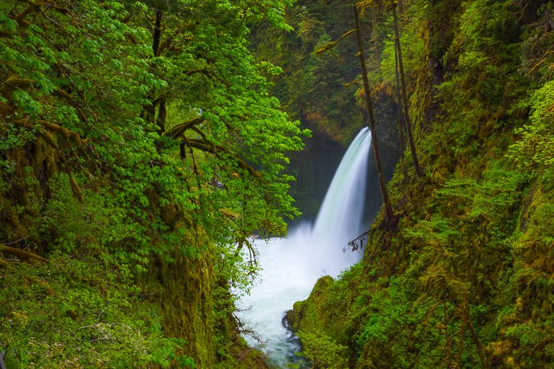
Eventually, however, I reached my first goal, as a spur off the trail led to an overlook of one of the places I'd most wanted to photograph for years, Metlako Falls. Unfortunately, just at the minute I reached the spur, the clouds parted and direct, contrast-killing sunlight streamed into the gorge. I had no option but to set up my camera and tripod (which necessitated climbing over the protective cable fence and positioning myself and my gear on an even-smaller ledge with a direct drop of well over a hundred feet) and wait for the clouds to move back in. Fortunately, within a few minutes, the sun was gone and I was able to get the images I had been wanting for a long time.
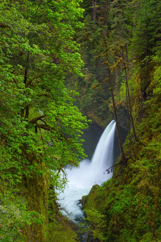
Since there is only one viewpoint for Metlako, I was limited in the possible compositions, but changed lenses and orientations for a few other versions.
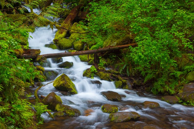
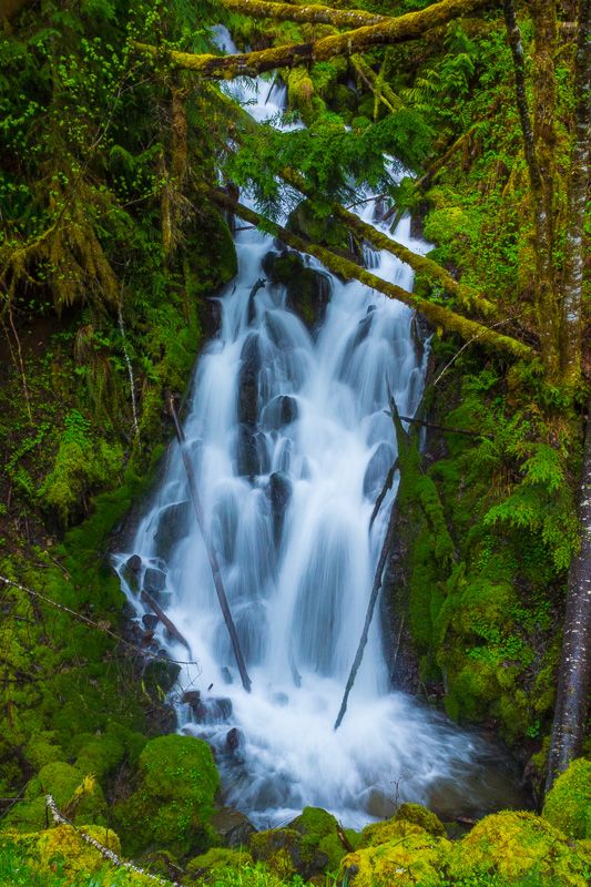
Returning to the main trail, I only went a short distance further before encountering Sorenson Creek.
Doesn't that look nice and photogenic? Only one small problem, which becomes obvious when you pull back a bit:
See that area in the center of the image? That's actually the trail itself, which, according to the guides, is supposed to cross Sorensen on a series of circular paving stones. Apparently, sometime during the winter or spring, all but two of those stones got washed away (and the ones that remained were completely underwater, not topping-off above the surface). There were only two options for proceeding further: wading ankle-deep through icy, rushing water, or trying to balance your way over a series of logs in the foreground. And one of the things not apparent from the photo is that, immediately past those logs, the creek turns into Sorenson Falls, plummeting a hundred feet or so into Eagle Creek itself (actually, if you look at the previous pictures of Metlako, Sorenson Falls can be glimpsed behind the large tree on the left). I watched as a number of hikers made their own attempts to cross, each turning into something worthy of America's Funniest Hiking Videos. Finally, after having used my trekking pole as a handhold to help someone get across the logjam, I decided that discretion was the better part of valor, and turned back (this turned out to be a wise choice, as I understand from later reports that the "beach" that forms the prime camera position for Punch Bowl Falls was likewise underwater). Oh, well, as a certain Republican-loving '70s rock star might have sung, "one out of two ain't bad." At any rate, I'll be back...but probably in late June, when more of the water will be restricted to the creek and falls, and less to giving me unplanned showers and footbaths.
Water Falling Over Things 2014: Part II (Up The Creeks)
It being the ideal weather for waterfall photography (in other words, gloomy with on-and-off rain), I spent Saturday in the Gifford Pinchot National Forest south of Mount St. Helens, searching out a series of falls which, coincidentally enough, all included "Creek" in their name.
First up, on the way to the "bigger shows," was a distant view of Rock Creek Falls along route 530.
Shortly thereafter, Curly Creek Falls - a unique demonstration of the erosive property of falling water - offers the unusual feature of a rock arch framing the drop.
Big Creek Falls provided a little bit of unexpected drama. Supposedly, according to the most-commonly-used guide (apparently written several years ago) you simply park at the signed parking lot and take the well-marked trail to the wooden observation deck. Which would be convenient, if there was still a sign. Or a parking lot. Or a trail. Or a wooden deck. Instead, the Forest Service, apparently confronted by maintenance challenges beyond their control but not simply wanting to publicly close the trail, took the rather Orwellian tack of deciding this was an "un-waterfall," erecting wooden stumps in front of the lot entrance, removing all signage, and letting the trail deteriorate, making this supposed easy walk into more of a light bushwhack. I saw no signs of a wooden deck; but there was a gravel-filled "platform," from which you could get an obstructed view of the fall.
Along Lewis River Road, there were a number of small unnamed roadside waterfalls that looked substantial enough to not be seasonal. While some were forgettable, this one, located about a half-mile west of Big Creek Falls, was quite photogenic.
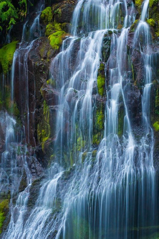
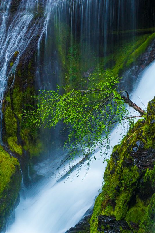
Finally, I looped back over McClellan Pass to Wind River Road, for the ultimate goal of this trip, Panther Creek Falls, one of the most unusual waterfalls in the Northwest.
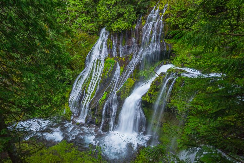
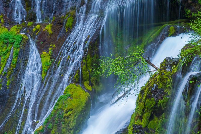
What makes Panther Creek Falls distinctive is that the creek itself splits into several branches before the fall, each coming down from a different direction and pattern.
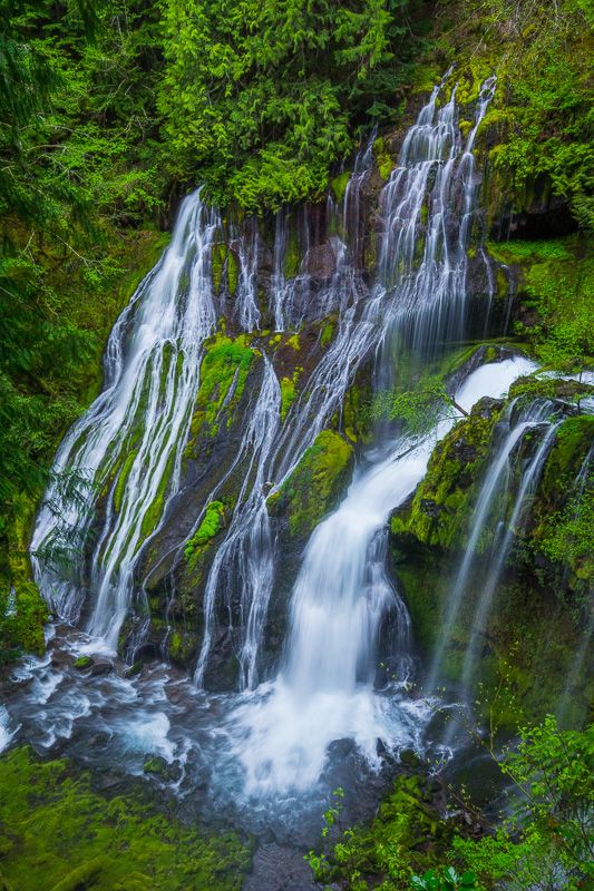
This allows not only for a nice overall view, but some wonderful opportunities for detail shots.
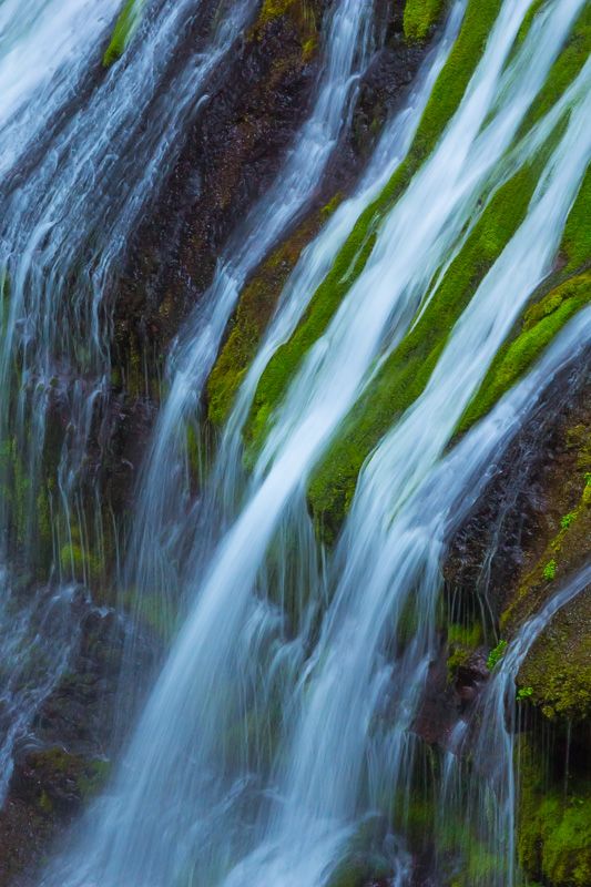
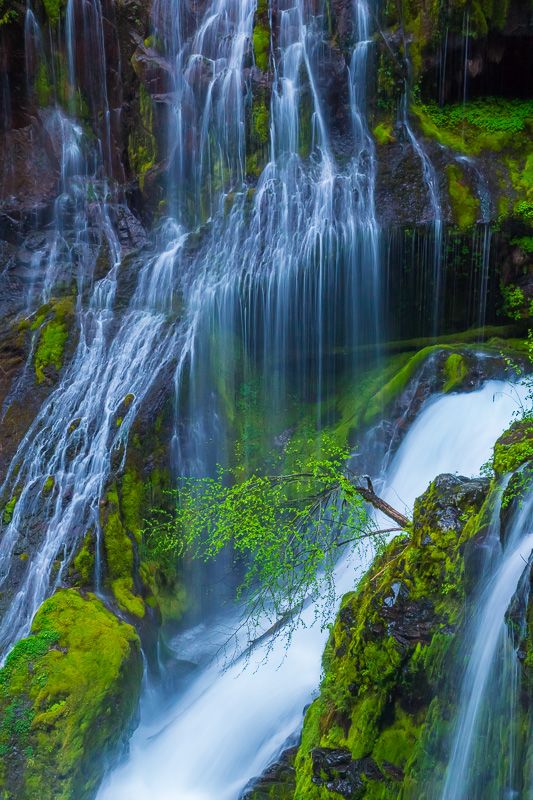
(Not sure whether I prefer the one above as a horizontal or vertical.)
All-in-all, a great way to spend a weekend day during a Northwest spring. Here's hoping we get more gloomy weather ahead, as there are a number of other locations I'm wanting to get to in the next month or so!
Profile Information
Gender: MaleHometown: Maple Valley, Washington
Member since: 2001
Number of posts: 26,044