Democratic Underground Latest Greatest Lobby Journals Search Options Help Login
Google

Hanna could become hurricane, hit East Coast

Printer-friendly format Printer-friendly format
Printer-friendly format Email this thread to a friend
Printer-friendly format Bookmark this thread
This topic is archived.
Home » Discuss » Latest Breaking News Donate to DU
 
villager Donating Member (1000+ posts) Send PM | Profile | Ignore Mon Sep-01-08 12:46 PM
Original message
Hanna could become hurricane, hit East Coast
Source: MSNBC

Hanna could become hurricane, hit East Coast
Landfall possible next week between Miami and N.C. Outer Banks

PROVIDENCIALES, Turks and Caicos - Tropical Storm Hanna brought battering waves, rain and blustery winds to this island chain on Monday, closing the main airport and schools and clearing the streets. Forecasters warned that it could become a hurricane and strike the U.S. mainland.

"Right now, the uncertainty is such that it could hit anywhere from Miami to the Outer Banks of North Carolina," said Jessica Schauer Clark, a meteorologist at the National Hurricane Center. "So people really need to keep an eye on it."

Tropical storm warnings were posted for the Turks and Caicos and the central and southeastern Bahamas, and the U.S. National Hurricane Center said the eighth named storm of the Atlantic hurricane season was likely to become a hurricane by midweek.

<snip>


Read more: http://www.msnbc.msn.com/id/26496933/
Printer Friendly | Permalink |  | Top
BlueCollar Donating Member (1000+ posts) Send PM | Profile | Ignore Mon Sep-01-08 12:52 PM
Response to Original message
1. Just anounced...hanna is now an official hurricane
Edited on Mon Sep-01-08 01:01 PM by BlueCollar
from www.noaa.gov

WTNT33 KNHC 011731
TCPAT3
BULLETIN
HURRICANE HANNA SPECIAL ADVISORY NUMBER 19
NWS TPC/NATIONAL HURRICANE CENTER MIAMI FL AL082008
130 PM AST MON SEP 01 2008

...HANNA BECOMES THE FOURTH HURRICANE OF THE SEASON...

AT 130 PM AST...1730 UTC...THE GOVERNMENT OF THE BAHAMAS HAS ISSUED
A HURRICANE WARNING FOR THE CENTRAL BAHAMAS...THE SOUTHEASTERN
BAHAMAS...AND THE TURKS AND CAICOS ISLANDS. A HURRICANE WARNING
MEANS THAT HURRICANE CONDITIONS ARE EXPECTED WITHIN THE WARNING
AREA WITHIN THE NEXT 24 HOURS. PREPARATIONS TO PROTECT LIFE AND
PROPERTY SHOULD BE RUSHED TO COMPLETION.

FOR STORM INFORMATION SPECIFIC TO YOUR AREA...INCLUDING POSSIBLE
INLAND WATCHES AND WARNINGS...PLEASE MONITOR PRODUCTS ISSUED
BY YOUR LOCAL WEATHER OFFICE.

AT 130 PM AST...1730Z...THE CENTER OF HURRICANE HANNA WAS LOCATED
NEAR LATITUDE 22.4 NORTH...LONGITUDE 72.6 WEST...OR VERY NEAR
MAYAGUANA ISLAND IN THE SOUTHEASTERN BAHAMAS.

HANNA IS MOVING TOWARD THE WEST-SOUTHWEST NEAR 5 MPH...7 KM/HR. A
SLOW MOTION TOWARD THE WEST-SOUTHWEST OR SOUTHWEST IS EXPECTED
TODAY FOLLOWED BY A TURN TOWARD THE WEST AND NORTHWEST
ON TUESDAY. ON THE FORECAST TRACK...HANNA WILL BE MOVING OVER THE
SOUTHEASTERN AND CENTRAL BAHAMAS DURING THE NEXT COUPLE OF DAYS.

MAXIMUM SUSTAINED WINDS ARE NEAR 75 MPH...120 KM/HR...WITH HIGHER
GUSTS. HANNA IS A CATEGORY ONE HURRICANE ON THE SAFFIR-SIMPSON
SCALE. SOME ADDITIONAL STRENGTHENING IS FORECAST DURING THE NEXT 24
HOURS.

HURRICANE FORCE WINDS EXTEND OUTWARD UP TO 70 MILES...110 KM...TO
THE NORTHEAST OF THE...AND TROPICAL STORM FORCE WINDS EXTEND
OUTWARD UP TO 160 MILES...260 KM. THE TURKS ISLAND JUST REPORTED A
WIND GUST OF 59 MPH...95 KP/HR.

THE MINIMUM CENTRAL PRESSURE REPORTED BY A RECONNAISSANCE AIRCRAFT
WAS 985 MB...29.09 INCHES.

HANNA IS EXPECTED TO PRODUCE RAINFALL AMOUNTS OF 4 TO 8 INCHES OVER
THE CENTRAL AND SOUTHEASTERN BAHAMAS...TURKS AND CAICOS ISLANDS...
WITH ISOLATED MAXIMUM AMOUNTS OF UP TO 12 INCHES POSSIBLE THROUGH
THURSDAY.

SWELLS FROM HANNA ARE EXPECTED TO INCREASE THE RISK OF DANGEROUS RIP
CURRENTS ALONG PORTIONS OF THE SOUTHEASTERN UNITED STATES COAST
DURING THE NEXT COUPLE OF DAYS.

REPEATING THE 130 PM AST POSITION...22.4 N...72.6 W. MOVEMENT
TOWARD...WEST-SOUTHWEST NEAR 5 MPH. MAXIMUM SUSTAINED WINDS...75
MPH. MINIMUM CENTRAL PRESSURE...985 MB.

THE NEXT ADVISORY WILL BE ISSUED BY THE NATIONAL HURRICANE
CENTER AT 500 PM AST.

$$
FORECASTER RHOME/AVILA
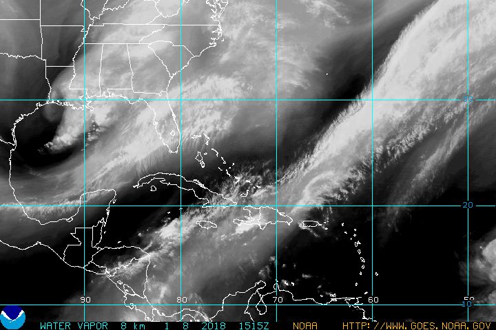


Printer Friendly | Permalink |  | Top
 
GoddessOfGuinness Donating Member (1000+ posts) Send PM | Profile | Ignore Mon Sep-01-08 01:03 PM
Response to Reply #1
2. ...and another tropical depression not far behind...
Batten down the hatches, folks. It's going to be a busy September.
Printer Friendly | Permalink |  | Top
 
RL3AO Donating Member (1000+ posts) Send PM | Profile | Ignore Mon Sep-01-08 01:05 PM
Response to Reply #2
3. Yep.
A STRONG TROPICAL WAVE LOCATED OVER THE FAR EASTERN ATLANTIC...A
COUPLE HUNDRED MILES SOUTHEAST OF THE CAPE VERDE ISLANDS...HAS
BECOME BETTER ORGANIZED AND A TROPICAL DEPRESSION COULD FORM LATER
TODAY OR TONIGHT. THIS SYSTEM IS FORECAST TO MOVE WESTWARD AT 15
TO 20 MPH.

Printer Friendly | Permalink |  | Top
 
zeemike Donating Member (1000+ posts) Send PM | Profile | Ignore Mon Sep-01-08 01:31 PM
Response to Reply #2
4. Looks like we got us a hurricane convoy n/t
Printer Friendly | Permalink |  | Top
 
villager Donating Member (1000+ posts) Send PM | Profile | Ignore Mon Sep-01-08 01:57 PM
Response to Reply #4
5. breaker breaker?
n/t
Printer Friendly | Permalink |  | Top
 
GoddessOfGuinness Donating Member (1000+ posts) Send PM | Profile | Ignore Mon Sep-01-08 06:40 PM
Response to Reply #4
7. And now that tropical depression is Tropical Storm Ike...
There's another disturbance off the coast of Africa that's higly likely to turn into a depression.

10-4 good buddy.
Printer Friendly | Permalink |  | Top
 
RedLetterRev Donating Member (1000+ posts) Send PM | Profile | Ignore Mon Sep-01-08 02:37 PM
Response to Reply #1
6. 5-Day Cone has it landing at Beaufort, SC and headed inland
around mid- to end of the week. Current projection has it progressing between Asheville and Hickory, NC where it will be a TD again at that point around Saturday.

TD9 (future Ike) is right behind Hanna and apparently on the same path.
Printer Friendly | Permalink |  | Top
 
Odin2005 Donating Member (1000+ posts) Send PM | Profile | Ignore Mon Sep-01-08 09:50 PM
Response to Original message
8. It's a God-damn hurricame conveyor belt!!!
:scared:
Printer Friendly | Permalink |  | Top
 
Strelnikov_ Donating Member (1000+ posts) Send PM | Profile | Ignore Mon Sep-01-08 10:55 PM
Response to Original message
9. GFDL Model Run
Printer Friendly | Permalink |  | Top
 
DU AdBot (1000+ posts) Click to send private message to this author Click to view 
this author's profile Click to add 
this author to your buddy list Click to add 
this author to your Ignore list Tue Apr 23rd 2024, 06:52 AM
Response to Original message
Advertisements [?]
 Top

Home » Discuss » Latest Breaking News Donate to DU

Powered by DCForum+ Version 1.1 Copyright 1997-2002 DCScripts.com
Software has been extensively modified by the DU administrators


Important Notices: By participating on this discussion board, visitors agree to abide by the rules outlined on our Rules page. Messages posted on the Democratic Underground Discussion Forums are the opinions of the individuals who post them, and do not necessarily represent the opinions of Democratic Underground, LLC.

Home  |  Discussion Forums  |  Journals |  Store  |  Donate

About DU  |  Contact Us  |  Privacy Policy

Got a message for Democratic Underground? Click here to send us a message.

© 2001 - 2011 Democratic Underground, LLC