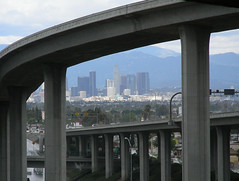
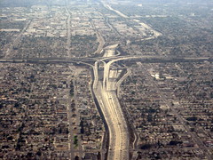
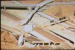
I don't think downtown will survive an 8.1 and if all of the freeways fall it will truly be a mess.
The following is from
http://en.wikipedia.org/wiki/Richter_magnitude_scaleRichter magnitudes Description Earthquake effects Frequency of occurrence
Less than 2.0 Micro Microearthquakes, not felt. About 8,000 per day
2.0-2.9 Minor Generally not felt, but recorded. About 1,000 per day
3.0-3.9 Often felt, but rarely causes damage. 49,000 per year (est.)
4.0-4.9 Light Noticeable shaking of indoor items, rattling noises. Significant damage unlikely. 6,200 per year (est.)
5.0-5.9 Moderate Can cause major damage to poorly constructed buildings over small regions. At most slight damage to well-designed buildings. 800 per year
6.0-6.9 Strong Can be destructive in areas up to about 160 kilometres (100 mi) across in populated areas. 120 per year
7.0-7.9 Major Can cause serious damage over larger areas. 18 per year
8.0-8.9 Great Can cause serious damage in areas several hundred miles across. 1 per year
9.0-9.9 Devastating in areas several thousand miles across.
1 per 20 years
10.0+ Epic Never recorded; see below for equivalent seismic energy yield.
Extremely rare (Unknown)
Here is a more complex listing since the power is on a logarithmic scale the intensity goes up a thousand fold every higher number.
Richter
Approximate Magnitude Approximate TNT for
Seismic Energy Yield Joule equivalent Example
0.0 15.0 g (0.529 oz) 63.1 kJ
0.5 84.4 g (2.98 oz) 355 kJ Large hand grenade
1.0 474 g (1.05 lb) 2.00 MJ Construction site blast
1.5 2.67 kg (5.88 lb) 11.2 MJ World War II conventional bombs
2.0 15.0 kg (33.1 lb) 63.1 MJ Late World War II conventional bombs
2.5 84.4 kg (186 lb) 355 MJ World War II blockbuster bomb
3.0 474 kg (1050 lb) 2.00 GJ Massive Ordnance Air Blast bomb
3.5 2.67 metric tons 11.2 GJ Chernobyl nuclear disaster, 1986
4.0 15.0 metric tons 63.1 GJ Small atomic bomb
4.5 84.4 metric tons 355 GJ
5.0 474 metric tons 2.00 TJ Seismic yield of Nagasaki atomic bomb (Total yield including air yield 21 kT, 88 TJ)
Lincolnshire earthquake (UK), 2008
2010 Central Canada earthquake<8><9>
5.5 2.67 kilotons 11.2 TJ Little Skull Mtn. earthquake (Nevada, USA), 1992
Alum Rock earthquake (California, USA), 2007
2008 Chino Hills earthquake (Los Angeles, USA)
6.0 15.0 kilotons 63.1 TJ Double Spring Flat earthquake (Nevada, USA), 1994
6.5 84.4 kilotons 355 TJ Caracas (Venezuela), 1967
Rhodes (Greece), 2008
Eureka Earthquake (Humboldt County, California, USA), 2010
Southeast of Taiwan (270 km), 2010
6.7 168 kilotons 708 TJ Northridge earthquake (California, USA), 1994
6.9 336 kilotons 1.41 PJ San Francisco Bay Area earthquake (California, USA), 1989
7.0 474 kilotons 2.00 PJ Java earthquake (Indonesia), 2009
2010 Haiti earthquake
7.1 670 kilotons 2.82 PJ 1944 San Juan earthquake
2010 Canterbury earthquake (New Zealand)
7.2 938 kilotons 3.94 PJ 1977 Vrancea earthquake (Romania)
2010 Baja California earthquake
7.5 2.67 megatons 11.2 PJ Kashmir earthquake (Pakistan), 2005
Antofagasta earthquake (Chile), 2007
7.8 7.52 megatons 31.6 PJ Tangshan earthquake (China), 1976
Hawke's Bay earthquake (New Zealand), 1931
1990 Luzon earthquake (Philippines)
April 2010 Sumatra earthquake (Indonesia)
8.0 15.0 megatons 63.1 PJ San Francisco earthquake (California, USA), 1906
Queen Charlotte Islands earthquake (Britsh Columbia, Canada), 1949
México City earthquake (Mexico), 1985
Gujarat earthquake (India), 2001
Chincha Alta earthquake (Peru), 2007
Sichuan earthquake (China), 2008
1894 San Juan earthquake
8.5 84.4 megatons 355 PJ Energy released is larger than that of the Tsar Bomba (50 megatons, 210 PJ), the largest thermonuclear weapon ever tested
Toba eruption 75,000 years ago; among the largest known volcanic events.<10>
Sumatra earthquake (Indonesia), 2007
8.8 238 megatons 1.00 EJ Chile earthquake, 2010
9.0 474 megatons 2.00 EJ Lisbon Earthquake (Lisbon, Portugal), All Saints Day, 1755
9.19.3 1.34 gigatons 5.62 EJ Indian Ocean earthquake, 2004
9.2 946 megatons 3.98 EJ Anchorage earthquake (Alaska, USA), 1964
9.5 2.67 gigatons 11.2 EJ Valdivia earthquake (Chile), 1960
10.0 15.0 gigatons 63.1 EJ Never recorded by humans
12.55 100 teratons 422 ZJ Yucatán Peninsula impact (creating Chicxulub crater) 65 Ma ago (108 megatons; over 4x1030 ergs = 400 ZJ)
UCI: Spanish Explorers Recorded First and Possibly Largest Quake in L.A.
Email this article
2002-03-20
042-KY-02
FOR IMMEDIATE RELEASE
SPANISH EXPLORERS RECORDED FIRST AND POSSIBLY LARGEST QUAKE IN LOS ANGELES HISTORY, SAY UCI RESEARCHERS
1769 Earthquake of Estimated 7 or Larger Magnitude Lifted Orange County Coastline 3 to 11 Feet; Indicates Active Fault Beneath San Joaquin Hills
Irvine, Calif., March 19, 2002 -- California's first recorded earthquake may have been the largest in the history of the Los Angeles basin and powerful enough to raise the Orange County shoreline more than 11 feet in some places, UC Irvine researchers say.
On July 28, 1769, Spanish explorer Gaspar de Portola and his men lay encamped on the banks of the Santa Ana River in what is now north Orange County. They felt a violent earthquake, followed by a number of aftershocks over the next several days. The Spanish measured the length of the shaking by the number of Hail Marys they could utter.
According to Lisa Grant, professor of environmental analysis and design at UCI's School of Social Ecology, the "severe" earthquake described in Portola's July 31 diary entry may have had a magnitude of 7.3, significantly larger than the 6.7-magnitude Northridge earthquake of 1994.
With plants, pollens, shells and a nod to Portola, Grant and UCI colleagues Leslie Ballenger and Eric Runnerstrom have traced geological and historical records to determine that a major earthquake occurred sometime between 1635 and 1855 in the San Joaquin Hills, most likely in 1769. In findings to be published in the March edition of the Bulletin of the Seismological Society of America, the researchers describe uplift averaging 1.8 meters--about 5 feet, 10 inches--along the shoreline from Corona del Mar to Dana Point. The most obvious cause, Grant claims, is a major earthquake, probably along the "blind," or underground, fault in the San Joaquin Hills that Grant first detected in 1999.
"The San Joaquin Hills cover an area previously thought to have low earthquake potential," Grant said. "In findings published in 1999, we discovered that a large-magnitude earthquake could occur here; now we've discovered it has occurred. Our research may the first documented evidence of an early historic or prehistoric blind thrust earthquake."
Grant and her research team used radiocarbon dating to determine the age of plants and shells from the elevated marsh bench, or ancient shoreline, in Upper Newport Bay and along the coastal San Joaquin Hills, finding that they must have been deposited no earlier than 1635. They measured the elevations of the marsh bench and the current shoreline and calculated the earthquake's magnitude from the amount of displacement it caused.
"The shoreline went up, and it went up quickly and by several meters," Grant said. "We knew an earthquake could do that, but there was no documented quake on the Pacific Coast prior to 1769."
So the researchers looked at the historical record of earthquakes since Portola's expedition, including an 1800 earthquake that cracked the walls of Mission San Juan Capistrano and an 1855 quake that may have generated a tsunami off Dana Point. Other researchers think the 1800 earthquake occurred further south or offshore, and the 1855 quake further north in Los Angeles County.
Finally, they studied data from the freshwater San Joaquin Marsh, which lies inland between UCI and Upper Newport Bay. Core samples from the marsh indicate a change in salinity that could have been caused by an earthquake lifting the marsh above sea level. And just above evidence in the sample of changed salinity, Grant said, "there are 'exotic' pollens--European pollens--which were introduced between 1776 and 1797."
The pollens suggest that the earthquake occurred just before, or at approximately the same time that the Spaniards arrived in Southern California. The pollens were the final bit of evidence needed to date, locate and measure the earthquake that Grant believes is the earliest and largest in the history of the Los Angeles basin and to help map the elusive fault that generated it.
"Unlike faults that come to the surface, such as the San Andreas fault, subterranean faults--like the San Joaquin Hills fault and the fault that generated the Northridge earthquake--are difficult to map. We have evidence that an active fault exists, but what it looks like, we don't know," Grant said.
Grant's research was supported by UCI and the Southern California Earthquake Center with funding from the National Science Foundation and United States Geological Survey.
UNIVERSITY OF CALIFORNIA, IRVINE: A TOP-10 PUBLIC UNIVERSITY