Democratic Underground Latest Greatest Lobby Journals Search Options Help Login
Google

Some perspective on Hurricane Katrina for Midwesterners

Printer-friendly format Printer-friendly format
Printer-friendly format Email this thread to a friend
Printer-friendly format Bookmark this thread
This topic is archived.
Home » Discuss » Archives » General Discussion (Through 2005) Donate to DU
 
Walt Starr Donating Member (1000+ posts) Send PM | Profile | Ignore Sun Aug-28-05 02:41 PM
Original message
Some perspective on Hurricane Katrina for Midwesterners
Edited on Sun Aug-28-05 02:44 PM by Walt Starr
The sustained winds in the eyewall are 175mph which is a Category 5 on the Saffir-Simpson scale.

But for midwesterners, the better comparison is the Fujita scale of tornado strength.

The wind speeds in the eyewall of Katrina fall squarely in the middle of the F3 tornado range. F3 tornadoes are EXTREMELY damaging, but are generally not huge, such as the OK City F5 tornado that was so devestating. An F3 tornado will still knock down houses and will create a swath of uprooted trees in a forest, just usually not in a swath bigger than about a half mile.

Now you have to look at the size of Katrina's eyewall. This hurricane has a HUGE eyewall, approximately 60 miles in diameter.

Midwesterners, you must now imagine AN F3 TORNADO 60 MILES WIDE!!! That's hell on earth!

Now, F2 winds will extend out from the center approximately 60 miles. That means an F2 tornado 120 MILES WIDE!!!

Hurricane force winds of Category 1 on the Saffir-Simpson scale still extend 105 miles from the center. That is still F1 tornado scale, 210 MILES WIDE!!!

So to put it all in terms Midewesterners can relate to, Hurricane Katrina is te equivalent of a 210 mile wide F1 tornado with an F2 tornado of 120 miles wide inside it with an F3 tornado of 60 miles wide inside that!

This is a devestation that is hardly imaginable. And what's worse than this monstrous tornado bearing down on New Orleans is the storm surge, because what the winds don't destroy, the flooding will.
Printer Friendly | Permalink |  | Top
Inland Donating Member (1000+ posts) Send PM | Profile | Ignore Sun Aug-28-05 02:44 PM
Response to Original message
1. Horrific devastation, for sure. Yet it seems so much is preventable.
I can't get out of the way of a tornado except to be lucky enough to have a basement within five minutes run.

There's days' worth of warning for hurricanes, but now that I am hearing about cutbacks and FEMA misoperation.....
Printer Friendly | Permalink |  | Top
 
1monster Donating Member (1000+ posts) Send PM | Profile | Ignore Sun Aug-28-05 04:30 PM
Response to Reply #1
28. One day is not in any way near enough time to evacuate an urban area
of any size.

A few years ago, Hurricane Floyd brushed the east Florida coast. My husband decided that that we would evacuate, so we packed up some necessiities and headed sixty miles south to I-4 with Venice, Florida as our planned destination.

I-4 is a stretch of Interstate that is somewhere around 125 miles long. We were on I-4 for seven hours moving at about five miles per hour when we were moving at all. The last 20 or thirty miles went at regular speed...

Had Floyd moved inland, we would have been sitting ducks on the Interstate along with thousands of other stranded motorists.

There are far, far to many people living in our coastal area for our current road systems to evacuate everyone.

There should be better planning and more emergency ways of evacuating threatened areas than there are.
Printer Friendly | Permalink |  | Top
 
Inland Donating Member (1000+ posts) Send PM | Profile | Ignore Mon Aug-29-05 10:07 AM
Response to Reply #28
35. Which is why it shouldn't all be one day.
One can see a hurricane from days away.

I don't understand how a hurricane that is coming on a Monday morning still finds most everyone bugging out on Sunday.
Printer Friendly | Permalink |  | Top
 
1monster Donating Member (1000+ posts) Send PM | Profile | Ignore Mon Aug-29-05 10:27 PM
Response to Reply #35
36. Because predicting where the hurricane will hit landfall is not an exact
science. I know people who were told to evacuate during Charlie (last year). Charlie missed their area of Florida and slammed into the area they evacuated they went to for safety.

At one point, one of last year's hurricanes looked like it was heading for a direct hit for our area, and we made plans with relatives to evacuate across the state. That hurricane ended up hitting their area and we were nice and safe (even with tropical storm winds) at home.

It isn't so much of a no brainer as it might seem.
Printer Friendly | Permalink |  | Top
 
MuseRider Donating Member (1000+ posts) Send PM | Profile | Ignore Sun Aug-28-05 02:47 PM
Response to Original message
2. I can't imagine.
I lived through an F5 that was 12 blocks wide and that was enough for me.

I am happy to live in tornado alley where I can almost always take cover before things get bad without having to do so in day long traffic jams. I have so much concern now for those stuck on the roads and those stuck in the city.

Interesting information Walt Starr, thanks for putting it together for us.
Printer Friendly | Permalink |  | Top
 
GreenPartyVoter Donating Member (1000+ posts) Send PM | Profile | Ignore Sun Aug-28-05 02:48 PM
Response to Reply #2
5. Tornadoes look scary too. I will stick with my blizzards and ice storms
Printer Friendly | Permalink |  | Top
 
MuseRider Donating Member (1000+ posts) Send PM | Profile | Ignore Sun Aug-28-05 03:00 PM
Response to Reply #5
16. They are actually
very interesting. The pressure changes give you strange feelings so it is a real trip to be out in the weather. I rarely take shelter but then I have lived here and dealt with it all my life and pretty much know when basement time is here.

The ice storm we had last year was probably nothing compared to what you all have but after hitting black ice on a overpass and almost going over the guard rail I am not at all interested in seeing what yours must be like! I ended up living in the small living area in my barn for a week after that since there was 2 inches if ice on the road and no money to do anything about it in my county.

I guess it is all what you are used to.
Printer Friendly | Permalink |  | Top
 
GreenPartyVoter Donating Member (1000+ posts) Send PM | Profile | Ignore Sun Aug-28-05 03:06 PM
Response to Reply #16
17. The ice storm of '98 sucked in a big way. Our trailer was just
a few houses away from power, but since we were across the town line we had no power since that feed had gone down.

We spent 10 days trying to heat the trailer with a kerosene heater during the day, losing all our heat during the night, and starting over again by morning. There was no running water, either.

I was 8 months pregnant and had influenza on top of it all. (The real kind, no some little tiddly flu bug.)

All in all, it sucked in a horrible way. That experience is a lot of the reason why I want a little eco-friendly passive/active solar house with a woodstove. I don't like not having alternatives for when the power goes out.
Printer Friendly | Permalink |  | Top
 
xmas74 Donating Member (1000+ posts) Send PM | Profile | Ignore Sun Aug-28-05 05:37 PM
Response to Reply #5
31. Tornados are kind of cool to watch!
When I was younger I would ride along w/ a few friends to watch them. I realize now that I am lucky to be alive.
Printer Friendly | Permalink |  | Top
 
ThoughtCriminal Donating Member (1000+ posts) Send PM | Profile | Ignore Sun Aug-28-05 02:47 PM
Response to Original message
3. OK, that's the wind - now tell us about storm surge
:scared:
Printer Friendly | Permalink |  | Top
 
Walt Starr Donating Member (1000+ posts) Send PM | Profile | Ignore Sun Aug-28-05 02:51 PM
Original message
Okay, here's the storm surge comparison
The storm surge is 28 feet high. Imagine a wall of water tweny eight feet high hitting Chicago.

Worse yet, New Orleans is 25 feet below sea level in some spots.

So in effect, portions of New Orleans will be under 53 feet of water for a period of time. And when it's all said and done, those areas will still be under 25 feet of water because New Orleans will act like a huge bowl and all the water will run into it.

We could be looking at Lake Orleans for weeks.
Printer Friendly | Permalink |  | Top
 
jpak Donating Member (1000+ posts) Send PM | Profile | Ignore Sun Aug-28-05 02:47 PM
Response to Original message
4. Tornadoes are also small and fast moving compared to hurricanes
Katrina's strongest winds will last for hours before and after the eye passes...

Printer Friendly | Permalink |  | Top
 
Walt Starr Donating Member (1000+ posts) Send PM | Profile | Ignore Sun Aug-28-05 02:53 PM
Response to Reply #4
10. And she's only moving at twelve miles per hour
That means being pounded by an F3 tornado for about an hour to an hour and a half.

After that, you will have two, maybe three hours of absolute calm because that huge eye will be over you. You'll think, damn, it's over. Nothing more. Hell, it's clear as a bell.

Then the backside of the eyewall will hit you for one to one and a half hours, yet another F3 tornado.
Printer Friendly | Permalink |  | Top
 
Eloriel Donating Member (1000+ posts) Send PM | Profile | Ignore Sun Aug-28-05 02:48 PM
Response to Original message
6. EXCELLENT analogy. Nominating --
It's also good for people who aren't Midwesterners. :evilgrin: No, seriously. It's graphic, and that's good.
Printer Friendly | Permalink |  | Top
 
Francine Frensky Donating Member (870 posts) Send PM | Profile | Ignore Sun Aug-28-05 03:31 PM
Response to Reply #6
23. Actually, this analogy seems wrong ....
--and I'm no weather expert I'll admit -- but living in the southeast after living in the midwest, I've noticed a few things about these hurricanes: one, the wind speeds always drop dramatically once the hurricane reaches landfall -- so it's not fair to assume that the 180 mph wind speeds over water will continue once landfall is reached. And two, the wind speeds are not consistently as high and steady as what is recorded over water, meaning they are swirling and gusty but don't wipe out everything in their path as a tornado does, the damage is more widespread but buildings and trees will survive in the midst of destruction.

Just observations, but another obvious difference is how long in advance people have to prepare for a hurricane whereas a twister can pop up literally in minutes.

Printer Friendly | Permalink |  | Top
 
Walt Starr Donating Member (1000+ posts) Send PM | Profile | Ignore Sun Aug-28-05 05:29 PM
Response to Reply #23
30. Nope, Analogy dead on
Edited on Sun Aug-28-05 05:30 PM by Walt Starr
Look at the following photos from Hurricane Andrew and from tornados....

Hurricane Andrew:


Oklahoma:


Andrew:


Vernon Texas:


Andrew:


Oklahoma City:


The problems with hurricanes are the length of time insanely high speed wnds affect an area coupled with the rain and rising tidal waters. Admittedly, the short term bursts of tornados have more immediately damaging effects, but a category five hurricane lasts so long with fluctuating wind speeds that the damage path is similar to that of a tornado, only miles wide instead blocks wide.
Printer Friendly | Permalink |  | Top
 
H5N1 Donating Member (777 posts) Send PM | Profile | Ignore Sun Aug-28-05 02:48 PM
Response to Original message
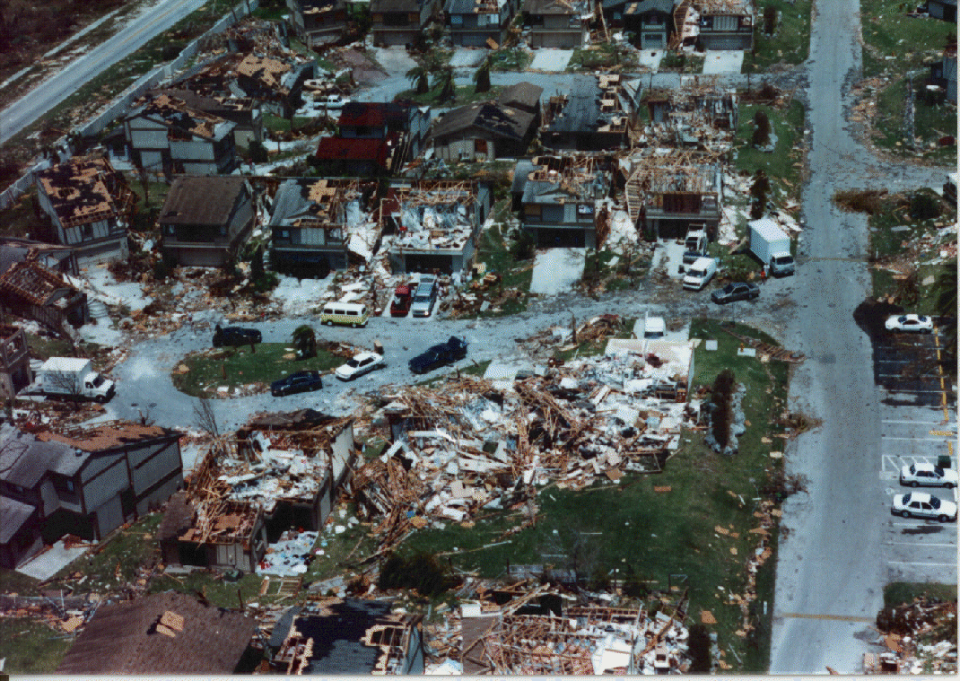
7. I've experienced my share of twisters
They sound like a cross between a train and a jet.
I would assume this monster is gonna be LOUD.
Printer Friendly | Permalink |  | Top
 
Surya Gayatri Donating Member (1000+ posts) Send PM | Profile | Ignore Sun Aug-28-05 02:51 PM
Response to Original message
8. Thanks for putting that in perspective, Walt
I'm a former midwesterner with long experience of tornadoes, so this makes the deadliness of the danger a lot more graphic, but much more scary.
God help all those in its path...praying for divine protection.
Printer Friendly | Permalink |  | Top
 
Mutley Donating Member (1000+ posts) Send PM | Profile | Ignore Sun Aug-28-05 02:52 PM
Response to Original message
9. Wonderful analogy.
Just what I was thinking earlier. Well done, Walt Starr
Printer Friendly | Permalink |  | Top
 
ret5hd Donating Member (1000+ posts) Send PM | Profile | Ignore Sun Aug-28-05 02:54 PM
Response to Original message
11. will new orleans even survive?
will it be wrecked beyond restoration?

i know that property means so little compared to lives, but i hate the thought of losing that much history.
Printer Friendly | Permalink |  | Top
 
Walt Starr Donating Member (1000+ posts) Send PM | Profile | Ignore Sun Aug-28-05 02:56 PM
Response to Reply #11
13. The probability is extremely high that on Tusday morning
parts of New Orleans will be under twenty-five feet of water.

If the Hurricane hits it dead on or slightly to the west of New Orleans, we will probably be looking at the most of the city becoming a lake.
Printer Friendly | Permalink |  | Top
 
Catbird Donating Member (633 posts) Send PM | Profile | Ignore Sun Aug-28-05 02:56 PM
Response to Original message
12. And to make matters worse . . .
Hurricanes often spawn tornados. So even if an area is somewhat away from the eyewall, it might get fierce tornados as the hurricane passes.

Printer Friendly | Permalink |  | Top
 
SlowDownFast Donating Member (1000+ posts) Send PM | Profile | Ignore Sun Aug-28-05 03:17 PM
Response to Reply #12
21. Tornadoes are already being predicted
as a side-effect result of this hurricane.
Printer Friendly | Permalink |  | Top
 
salin Donating Member (1000+ posts) Send PM | Profile | Ignore Sun Aug-28-05 02:57 PM
Response to Original message
14. add to this the time dimension
a very small tornado passed by my house and through our field about ten years ago. From start (when the sky got green) to finish no more than a couple of minutes.

The hurricane is HOURS - it doesn't just touch down and sweep around and then go away (granted wreaking extreme havoc where it hits) - the hurricane winds keep coming and coming and coming and coming....

I can't even imagine.

Printer Friendly | Permalink |  | Top
 
Fleshdancer Donating Member (1000+ posts) Send PM | Profile | Ignore Sun Aug-28-05 02:58 PM
Response to Original message
15. The local traffic cameras are already starting to shake
I'm watching the live stream from WDSU. The newscasters are doing an incredible job covering this. You can tell they're stressed and nervous.
Printer Friendly | Permalink |  | Top
 
Walt Starr Donating Member (1000+ posts) Send PM | Profile | Ignore Sun Aug-28-05 03:09 PM
Response to Original message
18. Okay, here's some more perspective....
Imagine, it's dark and it's been storming for some time. You start to be hit by an F1 tornado. And hit. And hit. This F1 tornado is hitting you for about 2 to 3 hours and right when you don't think you can take it any more, an F2 tornado starts hitting you, and hitting you, and hitting you. This F2 tornado hits you for about 2 or 3 hours and you're damn well sic of it when the F3 starts hitting you, and hitting you. The F3 hits for at least an hour, maybe an hour and a half.

And then, it's calm. The night is over and it's morning. You see clear sky above you, and the clear lasts and lasts. You think it's over because this period of time lasts 2 maybe 3 hours.

Then the F3 tornado is back. And it again lasts for an hour to 90 minutes before calming back down to the F2 tornado, which lasts another 2 to 3 hours and finally it calms down to an F1 tornado which again lasts 2 to 3 hours before becoming just a tropical storm with sustained winds under 75 iles per hour...

And all the while there is the rain, and the rain, and the rain. All the way through with the exception of the couple of hours of calm, the rain keeps coming down. And because of the storm surge the water keeps rising and rising. If you're in New Orleans, a 28 foot wall of water smashes past the levee, flooding most of the city.

This is not somting to be taken lightly. Pray for those poor people in the Superdome.
Printer Friendly | Permalink |  | Top
 
AgadorSparticus Donating Member (1000+ posts) Send PM | Profile | Ignore Sun Aug-28-05 03:09 PM
Response to Original message
19. excellent explanation! thanks.
:thumbsup:
Printer Friendly | Permalink |  | Top
 
Pithy Cherub Donating Member (1000+ posts) Send PM | Profile | Ignore Sun Aug-28-05 03:16 PM
Response to Original message
20. The sounds of crashes and explosions will be massive and ongoing.
The horrendous noise will be deafening for hours with little or no respite. My hands shake just imagining with what everybody is going to have to live through in the next 24 hours. Peace be unto everyone.
Printer Friendly | Permalink |  | Top
 
BeFree Donating Member (1000+ posts) Send PM | Profile | Ignore Sun Aug-28-05 03:24 PM
Response to Original message
22. Good analogy, using tornadoes
But not quite accurate as to wind speed.

A Cat 1 may have 90 mph winds, but those reach only 20 miles across and may not be sustained winds as a tornado might. Tropical force winds - below 74 mph to 35mph, can reach as far as 90 miles but greatly reduce speed the further from the center they are.

Now this storm: It has wind gusts up to 175 mph just around the center which is about 30 miles wide. The center, or the eye, changes shape frequently as it 'replaces' itself. As it contracts, as it has done today, the wind increases. When the eye widens, winds decrease, and the hope is the eye will widen as it reaches land.

NO is now getting the outer edges of the winds with about 25mph sustained and higher gusts. As the storm approaches winds increase. If you are 30 miles from the center, and it passes parallel to you, you may only experience half the wind speed that the center gets.

The highest storm surges can be quite high, but it takes all the right pieces in perfect alignment to attain 28 feet in height.

Were I near NO, or anywhere near the gulf coast on either side, I would be getting ready to leave. Godspeed to those who can leave, and may god bless those who can't.

Printer Friendly | Permalink |  | Top
 
BrklynLiberal Donating Member (1000+ posts) Send PM | Profile | Ignore Sun Aug-28-05 04:59 PM
Response to Reply #22
29. The radio announcemnt I heard said SUSTAINED winds of 175 mph.
:scared:
Printer Friendly | Permalink |  | Top
 
tgnyc Donating Member (1000+ posts) Send PM | Profile | Ignore Sun Aug-28-05 03:32 PM
Response to Original message
24. People who tried to wait out Andrew in their homes said
Edited on Sun Aug-28-05 03:33 PM by tgnyc
it sounded like a freight train running through the living room.

This is more powerful than Andrew.
Printer Friendly | Permalink |  | Top
 
tgnyc Donating Member (1000+ posts) Send PM | Profile | Ignore Sun Aug-28-05 03:38 PM
Response to Original message
25. One of the cable news nets read an announcement an hour ago,
I'm not sure the source -- perhaps the National Weather Service. But it was very bleak. It went something like:

Half of the homes with modern construction will be destroyed.

All houses with wood construction will be destroyed.

Many commercial buildings will be destroyed.

Tall bulidings will sway, some to the point of collapse.

Winds will carry debris that means certain death for anyone struck.

Water contamination will lead to human suffering "on a scale unimaginable in modern times."
Printer Friendly | Permalink |  | Top
 
Walt Starr Donating Member (1000+ posts) Send PM | Profile | Ignore Sun Aug-28-05 03:46 PM
Response to Reply #25
26. There were lots of bodies after Hurricane Camille on high ground.
Those people weren't killed by the wind or debris flying in the wind.

They did not drown.

They chose to head for higher ground, but the died any way.

So what killed them all?

Snakebite.
Printer Friendly | Permalink |  | Top
 
Chico Man Donating Member (1000+ posts) Send PM | Profile | Ignore Sun Aug-28-05 03:55 PM
Response to Original message
27. Rhode island is about 30 miles wide
Holy $hit!
Printer Friendly | Permalink |  | Top
 
BrklynLiberal Donating Member (1000+ posts) Send PM | Profile | Ignore Sun Aug-28-05 06:04 PM
Response to Original message
32. This confirms Walt Starr's description
http://www.pbs.org/now/transcript/transcript_neworleans.html


The City in a Bowl

DANIEL ZWERDLING: Maestri says consider this troubling fact: more than a million people live in this area, and they're stuck in a geological trap.

WALTER MAESTRI: New Orleans is, if you think about it, it's a soup bowl. Think of a soup bowl. And the soup bowl-- the high edges of the soup bowl-- is the Mississippi River. It's amazing to say, but the highest elevation in the city of New Orleans is at the Mississippi River.

DANIEL ZWERDLING: Maestri says, imagine what happens if a hurricane like Andrew comes raging up from the Gulf:

WALTER MAESTRI: The hurricane is spinning counter-clockwise. It's been pushing in front of it water from the Gulf of Mexico for days. It's now got a wall of water in front of it some 30, 40 feet high. As it approaches the levies of the-- the-- that surround the city, it tops those levees. As the storm continues to pass over. Now Lake Ponchetrain, that water from Lake Ponchartrain is now pushed on to that - those population which has been fleeing from the western side and everybody's caught in the middle. The bowl now completely fills. And we've now got the entire community underwater some 20, 30 feet underwater. Everything is lost.

DANIEL ZWERDLING: Remember the levees which the Army built, to hold smaller floods out of the bowl? Maestri says now those levees would doom the city. Because they'd trap the water in.


from earthside's post
http://www.democraticunderground.com/discuss/duboard.php?az=view_all&address=104x4487643
Printer Friendly | Permalink |  | Top
 
peacetalksforall Donating Member (1000+ posts) Send PM | Profile | Ignore Sun Aug-28-05 06:16 PM
Response to Original message
33. Walt, isn't the altitude of wind force also factored in? Andrew struck
close to the ground. ?
Printer Friendly | Permalink |  | Top
 
katinmn Donating Member (1000+ posts) Send PM | Profile | Ignore Sun Aug-28-05 08:01 PM
Response to Original message
34. I understand the comparison
Tornadoes here have decimated entire small towns in the past.

My heart is with the folks in LA and MS. It is going to be a rough night.
Printer Friendly | Permalink |  | Top
 
DU AdBot (1000+ posts) Click to send private message to this author Click to view 
this author's profile Click to add 
this author to your buddy list Click to add 
this author to your Ignore list Wed Apr 24th 2024, 06:13 AM
Response to Original message
Advertisements [?]
 Top

Home » Discuss » Archives » General Discussion (Through 2005) Donate to DU

Powered by DCForum+ Version 1.1 Copyright 1997-2002 DCScripts.com
Software has been extensively modified by the DU administrators


Important Notices: By participating on this discussion board, visitors agree to abide by the rules outlined on our Rules page. Messages posted on the Democratic Underground Discussion Forums are the opinions of the individuals who post them, and do not necessarily represent the opinions of Democratic Underground, LLC.

Home  |  Discussion Forums  |  Journals |  Store  |  Donate

About DU  |  Contact Us  |  Privacy Policy

Got a message for Democratic Underground? Click here to send us a message.

© 2001 - 2011 Democratic Underground, LLC