Democratic Underground Latest Greatest Lobby Journals Search Options Help Login
Google

Ophelia is a hurricane again....and she looks nasty

Printer-friendly format Printer-friendly format
Printer-friendly format Email this thread to a friend
Printer-friendly format Bookmark this thread
This topic is archived.
Home » Discuss » Archives » General Discussion (Through 2005) Donate to DU
 
Nikki Stone 1 Donating Member (1000+ posts) Send PM | Profile | Ignore Tue Sep-13-05 07:25 PM
Original message
Ophelia is a hurricane again....and she looks nasty
Printer Friendly | Permalink |  | Top
dweller Donating Member (1000+ posts) Send PM | Profile | Ignore Tue Sep-13-05 07:28 PM
Response to Original message
1. any new info?
our local NC didn't really talk it up, just more of the same from earlier today. I know they've mandatory evac'd part of the coast.

dp
Printer Friendly | Permalink |  | Top
 
Nikki Stone 1 Donating Member (1000+ posts) Send PM | Profile | Ignore Tue Sep-13-05 07:31 PM
Response to Reply #1
2. Which parts of the coast?
I had heard that Ophelia was a tropical storm earlier--now a hurricane again.
Printer Friendly | Permalink |  | Top
 
dweller Donating Member (1000+ posts) Send PM | Profile | Ignore Tue Sep-13-05 07:32 PM
Response to Reply #2
3. outer banks i think
i have family in Wilmington.

dp
Printer Friendly | Permalink |  | Top
 
Nikki Stone 1 Donating Member (1000+ posts) Send PM | Profile | Ignore Tue Sep-13-05 07:34 PM
Response to Reply #3
4. I've got a sister who was vacationing there. I hope she left.
Apparently, Virginia Beach/Hampton area is already preparing.

http://wavy.com/
Printer Friendly | Permalink |  | Top
 
justiceischeap Donating Member (1000+ posts) Send PM | Profile | Ignore Tue Sep-13-05 07:38 PM
Response to Reply #4
9. Yeah, they're testing the tunnels because two years ago
They either neglected to close off one of the tunnels or there was a malfunction. It shut down the midtown tunnel for over a month. If you're familiar with traffic in this area, that ain't a good thing.
Printer Friendly | Permalink |  | Top
 
katamaran Donating Member (352 posts) Send PM | Profile | Ignore Tue Sep-13-05 09:02 PM
Response to Reply #9
24. They're closing the Midtown tunnel tonight for testing
They're closing the Midtown tunnel tonight for testing...of course they're closing it right BEFORE I head home. Looks like the Downtown Tunnel for me tonight.

Isabel flooded the Midtown Tunnel about 2/3 of the way to the ends. One tube of the Downtown Tunnel had a few feet of water in it. And that was a pissant little barely category one hurricane. Hate to think what a category three would do. We;ve already said we'd pack the dogs and parrot into an RV and head dead west.
Printer Friendly | Permalink |  | Top
 
theHandpuppet Donating Member (1000+ posts) Send PM | Profile | Ignore Tue Sep-13-05 09:02 PM
Response to Reply #4
25. Some areas are under a mandatory evacuation
Hopefully she didn't have a choice in the matter and was told to get out.
Printer Friendly | Permalink |  | Top
 
CountAllVotes Donating Member (1000+ posts) Send PM | Profile | Ignore Tue Sep-13-05 07:35 PM
Response to Original message
5. ohhhhhhhh shiiiitttttt!!!!!!
Ophelia is gonna hit! Get the hell out of North/South Carolina now!

Are you reading this Peggy?

:scared:

:kick:
Printer Friendly | Permalink |  | Top
 
VTMechEngr Donating Member (1000+ posts) Send PM | Profile | Ignore Tue Sep-13-05 10:28 PM
Response to Reply #5
49. Uh, Its a Cat 1.
Most Houses in Virginia and NC are rated to a CAT 3. As long as you are not on a beach, the worst is a messy yard or a tree down.

I lived in Virginia Beach, Va for 19 years and weathered many 'canes.
Printer Friendly | Permalink |  | Top
 
CountAllVotes Donating Member (1000+ posts) Send PM | Profile | Ignore Tue Sep-13-05 10:31 PM
Response to Reply #49
50. my friend ...
She lives in Beaufort County, SC and in the last hurricane her place was damaged. She has insurance but hey, guess what, they would not pay for any of the repairs. She lives on the lowland of Hilton Head. I'm very worried for her.

I'm thinking she left already being she leaves every time a hurricane comes that way. Still the same I worry about her and everyone else in the Carolinas!

:kick:
Printer Friendly | Permalink |  | Top
 
Plausible Donating Member (386 posts) Send PM | Profile | Ignore Tue Sep-13-05 07:35 PM
Response to Original message
6. anyone know how things are in Wilmington?
Are they on mandatory evacuation?
Printer Friendly | Permalink |  | Top
 
ultraist Donating Member (1000+ posts) Send PM | Profile | Ignore Tue Sep-13-05 10:14 PM
Response to Reply #6
46. I have a friend in Wilmington, no they are not on mandatory evac
Okracoke island and somea areas of the outter banks are though (further north).

Printer Friendly | Permalink |  | Top
 
Carni Donating Member (1000+ posts) Send PM | Profile | Ignore Tue Sep-13-05 07:36 PM
Response to Original message
7. I hope she blows right up my brother in law's ass
I am sorry NC Duers that was highly inappropriate and I shouldn't have said that...I hope you all make out OK (but I do hope that SOB loses power and has to live in filth for a week)
Printer Friendly | Permalink |  | Top
 
marbuc Donating Member (1000+ posts) Send PM | Profile | Ignore Tue Sep-13-05 07:39 PM
Response to Reply #7
11. Ouch!
Don't like the guy eh?
Printer Friendly | Permalink |  | Top
 
Carni Donating Member (1000+ posts) Send PM | Profile | Ignore Tue Sep-13-05 07:57 PM
Response to Reply #11
18. He LOVES W
The last time I spoke to him (4 years ago) he was telling us that *blacks had smaller brains* that was it for me--I haven't spoken to the POS since.
Printer Friendly | Permalink |  | Top
 
still_one Donating Member (1000+ posts) Send PM | Profile | Ignore Tue Sep-13-05 07:58 PM
Response to Reply #7
19. tell us what you really feel about your brother in law
don't hold back now


Printer Friendly | Permalink |  | Top
 
Carni Donating Member (1000+ posts) Send PM | Profile | Ignore Tue Sep-13-05 08:33 PM
Response to Reply #19
21. I was totally holding back previously EOM
Printer Friendly | Permalink |  | Top
 
still_one Donating Member (1000+ posts) Send PM | Profile | Ignore Tue Sep-13-05 10:39 PM
Response to Reply #21
51. Sorry about that. Some people just aren't human beings
Edited on Tue Sep-13-05 10:40 PM by still_one
I was actually kidding, and I sure didn't mean to offend

Printer Friendly | Permalink |  | Top
 
Name removed Donating Member (0 posts) Send PM | Profile | Ignore Tue Sep-13-05 07:37 PM
Response to Original message
8. Deleted message
Message removed by moderator. Click here to review the message board rules.
 
VADem11 Donating Member (783 posts) Send PM | Profile | Ignore Tue Sep-13-05 07:38 PM
Response to Original message
10. The problem
will probably be with the rain and flooding and not the wind. It is moving at 3 miles per hour which is extremely slow. Sort of like Frances last year. I hope the carolinas are okay.
Printer Friendly | Permalink |  | Top
 
La Coliniere Donating Member (581 posts) Send PM | Profile | Ignore Tue Sep-13-05 07:40 PM
Response to Original message
12. Followed right on the heels by Hurricane Polonius.
Sorry. Couldn't resist. "Get thee to a nunnery, or a freaking storm shelter".
Printer Friendly | Permalink |  | Top
 
Nikki Stone 1 Donating Member (1000+ posts) Send PM | Profile | Ignore Tue Sep-13-05 07:45 PM
Response to Original message
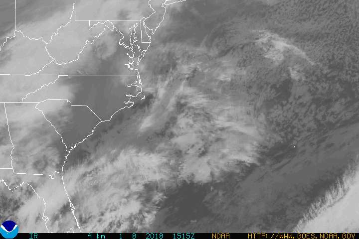
13. Here's the latest
Ophelia Regains Hurricane Strength


By PAUL NOWELL, Associated Press Writer 2 hours, 2 minutes ago

WRIGHTSVILLE BEACH, N.C. - Vulnerable islands were evacuated and mainland schools were closed Tuesday as Ophelia again strengthened to a hurricane and wobbled closer to land with a threat of flooding rain.

The National Hurricane Center upgraded the storm's status Tuesday evening, saying maximum sustained winds had reached 75 mph, with higher gusts. The storm was graded a Category One hurricane, but the center said further strengthening was possible in the hours ahead....

...A hurricane warning extended from the South Santee River in South Carolina north to Oregon Inlet at Pamlico Sound in North Carolina, meaning hurricane conditions were expected within 24 hours.

A hurricane watch and tropical storm warning were in effect from the Oregon Inlet north to the North Carolina-Virginia line and southward from the South Santee River to Edisto Beach in South Carolina....

http://news.yahoo.com/s/ap/20050913/ap_on_re_us/tropical_weather


Printer Friendly | Permalink |  | Top
 
dweller Donating Member (1000+ posts) Send PM | Profile | Ignore Tue Sep-13-05 07:46 PM
Response to Reply #13
14. here's NOAA info
Edited on Tue Sep-13-05 07:54 PM by dweller
http://www.nhc.noaa.gov/text/refresh/MIATCPAT1+shtml/132345.shtml


Outer Banks area mand.evac was for visitors, not locals. Next update, 11pm.

edit: mand.evac was for all on the Outer Banks, except Ocracoke (?) .

dp
Printer Friendly | Permalink |  | Top
 
Nikki Stone 1 Donating Member (1000+ posts) Send PM | Profile | Ignore Tue Sep-13-05 07:47 PM
Response to Reply #13
15. And specifically these areas
"At least six North Carolina counties ordered mandatory evacuations of some areas and seven others had voluntary evacuations.

Along the exposed Outer Banks chain, all residents and visitors were ordered to evacuate Hatteras Island on Tuesday, visitors had been ordered off Ocracoke Island and the National Park Service closed the Cape Hatteras lighthouse and the Wright Brothers National Memorial in Kill Devil Hills.

Schools were closed in several coastal counties in both North and South Carolina, while classes were canceled at the University of North Carolina at Wilmington and East Carolina University in Greenville.

The Air Force sent some aircraft from bases in Virginia and North Carolina to airfields farther inland and moved others into hangars."
Printer Friendly | Permalink |  | Top
 
slackmaster Donating Member (1000+ posts) Send PM | Profile | Ignore Tue Sep-13-05 07:48 PM
Response to Original message
16. Let me guess - right up the Cape Fear River
I hope my friends over there are prepared.
Printer Friendly | Permalink |  | Top
 
Plausible Donating Member (386 posts) Send PM | Profile | Ignore Tue Sep-13-05 07:54 PM
Response to Original message
17. possibly 5 to 15 inches of rain
one to three inches an hour maybe in wilimington area, street flooding likely. power outages expected,....weather channel on tv is saying
Printer Friendly | Permalink |  | Top
 
Plausible Donating Member (386 posts) Send PM | Profile | Ignore Tue Sep-13-05 08:01 PM
Response to Original message
20. storming in wilmington, raining hard wind blowing
yard flooding at relative.......oh phone now
Printer Friendly | Permalink |  | Top
 
applegrove Donating Member (1000+ posts) Send PM | Profile | Ignore Tue Sep-13-05 08:59 PM
Response to Original message
22. Oh shit. She got her stuff together. Wonder if it will be next Tuesday
before FEMA arrives and allows troops & rescuers through?
Printer Friendly | Permalink |  | Top
 
applegrove Donating Member (1000+ posts) Send PM | Profile | Ignore Tue Sep-13-05 09:01 PM
Response to Original message
23. You just cannot underestimate the power of warm water, caused by
global warming, to organize even the most mixed up of tropical storms. Kind of like "fear" the WH uses - every day to control people. Fear rises to the top of emotions too.
Printer Friendly | Permalink |  | Top
 
Boomer Donating Member (1000+ posts) Send PM | Profile | Ignore Tue Sep-13-05 09:08 PM
Response to Original message
26. Oh gods, my co-worker is going to lose it
Not because she has family in the area, or is worried about the people who may lose their homes or their lives.

No, she's worried about her wedding which is scheduled to be held near Hatteras Island.

Plans, obviously, subject to change....
Printer Friendly | Permalink |  | Top
 
dsc Donating Member (1000+ posts) Send PM | Profile | Ignore Tue Sep-13-05 09:19 PM
Response to Original message
27. I live about 30 miles west of Greeneville
and our schools are scheduled to be open tommorrow but we will get a call sometime before 6am telling us for sure if we are. I admit I was kind of poo pooing these hurricanes until Katrina. Now if I hear of a category 3 or higher heading here I will be driving west as fast as I can get away with.
Printer Friendly | Permalink |  | Top
 
geomon666 Donating Member (1000+ posts) Send PM | Profile | Ignore Tue Sep-13-05 09:23 PM
Response to Original message
28. 5 Day track has it skimming the NC coast.
http://www.nhc.noaa.gov/storm_graphics/AT16/refresh/AL1605W5_sm2+gif/214052W_sm.gif


However it should be noted:

OPHELIA IS MOVING TO THE NORTH-NORTHWEST NEAR 3 MPH... AND THIS
GENERAL MOTION IS EXPECTED TO CONTINUE TONIGHT. A TURN TO
THE NORTH IS EXPECTED ON WEDNESDAY. HOWEVER...STEERING CURRENTS
REMAIN WEAK...AND AN ERRATIC MOTION IS LIKELY.


MAXIMUM COASTAL STORM SURGE FLOODING OF 5 TO 7 FEET ABOVE NORMAL
TIDE LEVELS...ALONG WITH LARGE AND DANGEROUS BATTERING WAVES...CAN
BE EXPECTED IN AREAS OF ONSHORE FLOW. A STORM SURGE OF 8 TO 10
FEET IS POSSIBLE AT THE HEADS OF BAYS AND RIVERS.

OPHELIA IS EXPECTED TO PRODUCE TOTAL RAINFALL ACCUMULATIONS OF 6 TO
10 INCHES OVER EXTREME NORTHEASTERN SOUTH CAROLINA AND OVER EASTERN
NORTH CAROLINA...WITH POSSIBLE ISOLATED MAXIMUM AMOUNTS OF 15
INCHES OVER EASTERN NORTH CAROLINA.

ISOLATED TORNADOES ARE POSSIBLE ALONG THE COASTAL AREAS OF NORTH
CAROLINA TONIGHT AND WEDNESDAY.


Shouldn't be too bad I don't think.
Printer Friendly | Permalink |  | Top
 
pfitz59 Donating Member (1000+ posts) Send PM | Profile | Ignore Tue Sep-13-05 09:28 PM
Response to Reply #28
29. If it hugs the coast for a few days....
could cover the whole eastern seaboard! Everything from SC to Maine is in its path!
Printer Friendly | Permalink |  | Top
 
geomon666 Donating Member (1000+ posts) Send PM | Profile | Ignore Tue Sep-13-05 09:29 PM
Response to Reply #29
30. It'll get weaker the farther north it goes.
The cooler water will kill it.
Printer Friendly | Permalink |  | Top
 
Maru Kitteh Donating Member (1000+ posts) Send PM | Profile | Ignore Tue Sep-13-05 09:36 PM
Response to Reply #30
33. Back in the days before global warming sure
water temps are way up from normal, including the north.

Someday in the not so distant future we will be dealing with a major hurricane in NYC, or another densely populated northern locale.
Printer Friendly | Permalink |  | Top
 
geomon666 Donating Member (1000+ posts) Send PM | Profile | Ignore Tue Sep-13-05 09:51 PM
Response to Reply #33
38. The northern waters are still cooler than the southern waters. n/t
Printer Friendly | Permalink |  | Top
 
Maru Kitteh Donating Member (1000+ posts) Send PM | Profile | Ignore Tue Sep-13-05 10:44 PM
Response to Reply #38
52. I know, and I agree, all I'm saying is we can't be thinking of these
things the way we were used to, we can't count on them to behave the way we expect anymore. We are in a new cycle now and have the combined global energy policies and practices of the last 200 +- years colliding in ways that will bring much more death and much more misery.
Printer Friendly | Permalink |  | Top
 
theHandpuppet Donating Member (1000+ posts) Send PM | Profile | Ignore Tue Sep-13-05 09:34 PM
Response to Reply #28
32. This is the part of the report that scares me....
MAXIMUM COASTAL STORM SURGE FLOODING OF 5 TO 7 FEET ABOVE NORMAL
TIDE LEVELS...ALONG WITH LARGE AND DANGEROUS BATTERING WAVES...CAN
BE EXPECTED IN AREAS OF ONSHORE FLOW. A STORM SURGE OF 8 TO 10
FEET IS POSSIBLE AT THE HEADS OF BAYS AND RIVERS.

Folks who've never been to the barrier islands of NC don't realize these are extremely narrow, flat strips of land and even minor storm surge can wash competely over these islands. The ecosystem there is delicate and could sustain major damage even with a level one hurricane, especially if it moves right up the sound.
Printer Friendly | Permalink |  | Top
 
Nikki Stone 1 Donating Member (1000+ posts) Send PM | Profile | Ignore Tue Sep-13-05 09:41 PM
Response to Reply #32
35. Yeah, this could be bad
...
Printer Friendly | Permalink |  | Top
 
SaveAmerica Donating Member (1000+ posts) Send PM | Profile | Ignore Tue Sep-13-05 10:08 PM
Response to Reply #32
42. Making it worse is that she's just moseying along, she'll be dumping
loads of water as she takes her sweet little time. I feel bad for the New Orleans evacuees who ended up seeking shelter there.
Printer Friendly | Permalink |  | Top
 
burythehatchet Donating Member (1000+ posts) Send PM | Profile | Ignore Tue Sep-13-05 09:31 PM
Response to Original message
31. Is FEMA handing out cash to Nags Head residents?
:shrug:
Printer Friendly | Permalink |  | Top
 
BlackVelvetElvis Donating Member (1000+ posts) Send PM | Profile | Ignore Tue Sep-13-05 09:36 PM
Response to Original message
34. My friend is on her honeymoon in Myrtle Beach
Since last Saturday until this weekend.
I hope they are doing well.
Printer Friendly | Permalink |  | Top
 
Window Donating Member (1000+ posts) Send PM | Profile | Ignore Tue Sep-13-05 09:59 PM
Response to Reply #34
40. I have two daughters and their families in Myrtle Beach.
They closed the schools and businesses for today and tomorrow (and the rest of the week if necessary). They also have shelters set up. Needless to say, they are extremely nervous after Katrina.
Printer Friendly | Permalink |  | Top
 
bdot Donating Member (298 posts) Send PM | Profile | Ignore Tue Sep-13-05 09:47 PM
Response to Original message
36. This thing is a wimp!
We need rain in the Raleigh area. This thing is turning and heading away. ARGH!!!!!!!!!
Printer Friendly | Permalink |  | Top
 
LisaL Donating Member (1000+ posts) Send PM | Profile | Ignore Tue Sep-13-05 09:48 PM
Response to Original message
37. She is a crazy one. Can't make up her mind.
Printer Friendly | Permalink |  | Top
 
Nikki Stone 1 Donating Member (1000+ posts) Send PM | Profile | Ignore Tue Sep-13-05 09:57 PM
Response to Reply #37
39. That's what is so annoying about Ophelia
It's hard to tell what is going to happen.
Printer Friendly | Permalink |  | Top
 
katamaran Donating Member (352 posts) Send PM | Profile | Ignore Tue Sep-13-05 10:11 PM
Response to Reply #39
45. Let's hope Pat Robertson prays it away
:evilgrin:
Printer Friendly | Permalink |  | Top
 
LittleClarkie Donating Member (1000+ posts) Send PM | Profile | Ignore Tue Sep-13-05 10:00 PM
Response to Original message
41. GET THE FUCK AWAY FROM NORFOLK YOU @#$%&
Hey man, I'm FROM Virginia. I don't remember in my first 10 years of life being in the middle of a hurricane. But it looks like after South Carolina, will come me ol' stompin' grounds. Eesh. I hope those guys will be okay. It's still a 1, isn't it?
Printer Friendly | Permalink |  | Top
 
katamaran Donating Member (352 posts) Send PM | Profile | Ignore Tue Sep-13-05 10:09 PM
Response to Reply #41
43. Isabel and Floyd were only a category ones
Problem with Isabel was that we'd had a very wet summer, so the ground was soft. Trees were toppling like Jenga blocks. Same thing with Floyd...we'd had a weak hurricane spinning off the coast (Dennis I think) that soaked us a week before, then came in and flooded the holy HELL out of northeastern NC and Franklin VA. I also remember Gloria when I was a kid in the 80's...and I was at college in the mountains when Fran passed right over my fricking dorm (classes weren't cancelled...go figure!)
Printer Friendly | Permalink |  | Top
 
SlavesandBulldozers Donating Member (1000+ posts) Send PM | Profile | Ignore Tue Sep-13-05 10:18 PM
Response to Reply #43
47. i remember when Floyd looked like it was going to slam into Florida
it was gigantic and everybody thought we were going to get hit head-on. so Floyd wasn't that strong when it made landfall up North eh? I didn't know that.
Printer Friendly | Permalink |  | Top
 
QC Donating Member (1000+ posts) Send PM | Profile | Ignore Tue Sep-13-05 10:10 PM
Response to Original message
44. Weak cat. 1 so far--shouldn't be too bad.
Well, you know what I mean. Not fun, but not devastating either.
Printer Friendly | Permalink |  | Top
 
Xithras Donating Member (1000+ posts) Send PM | Profile | Ignore Tue Sep-13-05 10:21 PM
Response to Reply #44
48. Yep, the eyewall is poorly defined.
A poorly defined eyewall means a less organized storm and smaller storm surge. It also makes it far more likely that the storm will fall apart as it hits the coast.

All hurricanes are bad, but they really don't get much weaker than this.
Printer Friendly | Permalink |  | Top
 
dweller Donating Member (1000+ posts) Send PM | Profile | Ignore Tue Sep-13-05 11:07 PM
Response to Original message
53. the latest NOAA advisory
meant to post at 11, sorry.

http://www.nhc.noaa.gov/text/refresh/MIATCPAT1+shtml/132345.shtml

it appear to just sit there and soak the coast. Reminds me of H. Diane (?) that took almost a week to get out of town.

dp
Printer Friendly | Permalink |  | Top
 
DU AdBot (1000+ posts) Click to send private message to this author Click to view 
this author's profile Click to add 
this author to your buddy list Click to add 
this author to your Ignore list Fri Apr 26th 2024, 08:19 AM
Response to Original message
Advertisements [?]
 Top

Home » Discuss » Archives » General Discussion (Through 2005) Donate to DU

Powered by DCForum+ Version 1.1 Copyright 1997-2002 DCScripts.com
Software has been extensively modified by the DU administrators


Important Notices: By participating on this discussion board, visitors agree to abide by the rules outlined on our Rules page. Messages posted on the Democratic Underground Discussion Forums are the opinions of the individuals who post them, and do not necessarily represent the opinions of Democratic Underground, LLC.

Home  |  Discussion Forums  |  Journals |  Store  |  Donate

About DU  |  Contact Us  |  Privacy Policy

Got a message for Democratic Underground? Click here to send us a message.

© 2001 - 2011 Democratic Underground, LLC