Democratic Underground Latest Greatest Lobby Journals Search Options Help Login
Google

Ophelia may affect entire east coast now!

Printer-friendly format Printer-friendly format
Printer-friendly format Email this thread to a friend
Printer-friendly format Bookmark this thread
This topic is archived.
Home » Discuss » Archives » General Discussion (Through 2005) Donate to DU
 
msongs Donating Member (1000+ posts) Send PM | Profile | Ignore Wed Sep-14-05 11:16 PM
Original message
Ophelia may affect entire east coast now!
(glad to see this page is loading now)

according to NOAA ophelia as a tropical storm may shift west some and affect the entire east coast instead of heading out to sea off North Carolina:

000
WTNT41 KNHC 150257
TCDAT1
HURRICANE OPHELIA DISCUSSION NUMBER 36
NWS TPC/NATIONAL HURRICANE CENTER MIAMI FL
11 PM EDT WED SEP 14 2005

THE INTENSITY ESTIMATE REMAINS 75 KT...BASED ON 84 KT WINDS AT 700
MB IN THE SOUTH EYEWALL...AND A 10-MIN MEAN WIND FROM CAPE LOOKOUT
OF 64 KT. HOWEVER...THE CENTRAL PRESSURE IS UP A LITTLE AND THE
EYEWALL HAS ERODED A BIT...SO OPHELIA MAY HAVE REACHED ITS PEAK
INTENSITY. WATER VAPOR IMAGERY SHOWS THAT A SURGE OF
NORTHWESTERLIES IN THE MID- TO UPPER-TROPOSPHERE IS RAPIDLY
UNDERCUTTING THE OUTFLOW IN THE NORTHWEST QUADRANT. WHILE THIS MAY
BE TEMPORARILY ENHANCING CONVECTION IN THE WESTERN EYEWALL...I HAVE
TO THINK THAT THIS FLOW WILL BE A DISRUPTIVE INFLUENCE ON THE
CIRCULATION IN ANOTHER 6-12 HOURS OR SO. THE GFDL MODEL SHOWS SOME
WEAKENING IN THE SHORT TERM AS WELL. THE OFFICIAL INTENSITY
FORECAST IS A LITTLE BIT UNDER THE PREVIOUS ADVISORY.

THE INITIAL MOTION IS 060/6. MODEL GUIDANCE HAS SHIFTED QUITE A BIT
TO THE LEFT...WITH THE NOGAPS...GFDL...GFS...AND UKMET TAKING
OPHELIA CLOSE ENOUGH TO THREATEN NEW ENGLAND AND NOVA SCOTIA WITH
TROPICAL STORM FORCE WINDS. THIS APPEARS TO BE DUE TO THE TROUGH
COMING OUT OF THE ROCKIES BEING DEEPER OVER THE EASTERN UNITED
STATES...AND A MORE PERSISTENT HIGH PRESSURE NORTH OF BERMUDA.
GIVEN THE CONSISTENT SHIFT IN ALL THE GUIDANCE...I HAVE ADJUSTED
THE TRACK TO THE LEFT...BUT FURTHER ADJUSTMENTS IN THAT DIRECTION
DOWN THE ROAD MAY BE REQUIRED.

http://www.nhc.noaa.gov/text/refresh/MIATCDAT1+shtml/150257.shtml

gonna be a wet week. Hope bushco know where the rain is coming from THIS time.

Msongs
www.msongs.com/liberaltshirts.htm
Printer Friendly | Permalink |  | Top
Nikki Stone 1 Donating Member (1000+ posts) Send PM | Profile | Ignore Wed Sep-14-05 11:20 PM
Response to Original message
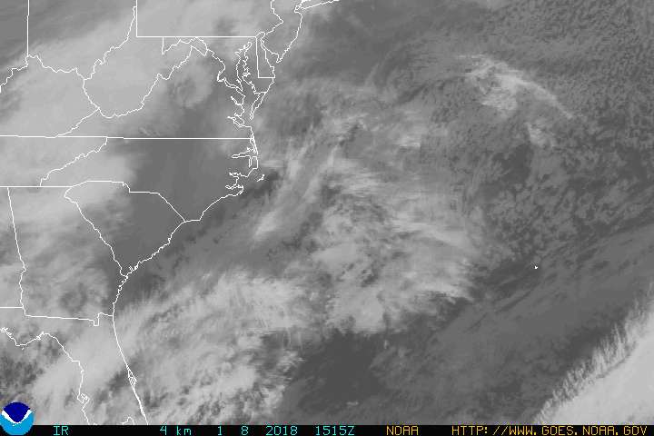
1. Satellite Photo now
Printer Friendly | Permalink |  | Top
 
Liberty Belle Donating Member (1000+ posts) Send PM | Profile | Ignore Wed Sep-14-05 11:23 PM
Response to Original message
2. It would be poetic justice if...
It tore the roof off Cheney's new mansion, then made a beeline for the oval office.
Printer Friendly | Permalink |  | Top
 
dweller Donating Member (1000+ posts) Send PM | Profile | Ignore Wed Sep-14-05 11:25 PM
Response to Reply #2
3. from your keyboard
to Mother Nature's ways.

dp
Printer Friendly | Permalink |  | Top
 
msongs Donating Member (1000+ posts) Send PM | Profile | Ignore Wed Sep-14-05 11:25 PM
Response to Reply #2
4. yeah bush can stand on the roof with a "rescue me" sign LOL nt
Printer Friendly | Permalink |  | Top
 
FreedomAngel82 Donating Member (1000+ posts) Send PM | Profile | Ignore Wed Sep-14-05 11:26 PM
Response to Reply #4
5. With Barney
Printer Friendly | Permalink |  | Top
 
shadowknows69 Donating Member (1000+ posts) Send PM | Profile | Ignore Wed Sep-14-05 11:28 PM
Response to Reply #5
7. ill rescue barney
Printer Friendly | Permalink |  | Top
 
Bernardo de La Paz Donating Member (1000+ posts) Send PM | Profile | Ignore Wed Sep-14-05 11:31 PM
Response to Reply #4
9. Come and Git Me Now
Printer Friendly | Permalink |  | Top
 
malaise Donating Member (1000+ posts) Send PM | Profile | Ignore Thu Sep-15-05 04:46 AM
Response to Reply #2
22. Damn
last week I asked whether the models suggested that Ophelia would hit DC since I had a dream that she did. Thought my subconscious was doing overtime.
Printer Friendly | Permalink |  | Top
 
msongs Donating Member (1000+ posts) Send PM | Profile | Ignore Wed Sep-14-05 11:27 PM
Response to Original message
6. NOAA also has new tropical storm developing watch for middle
tropical atlantic...an area that could develop a tropical storm in 24-26 hours. It is northeast of south america and quite far east.

Msongs
www.msongs.com/liberaltshirts.htm
Printer Friendly | Permalink |  | Top
 
gulfcoastliberal Donating Member (1000+ posts) Send PM | Profile | Ignore Wed Sep-14-05 11:31 PM
Response to Reply #6
8. They're lining up from S America to Cape Verde:


Printer Friendly | Permalink |  | Top
 
whistle Donating Member (1000+ posts) Send PM | Profile | Ignore Wed Sep-14-05 11:42 PM
Response to Original message
10. Projected now to move up the east coast taking the following path
Printer Friendly | Permalink |  | Top
 
cliss Donating Member (1000+ posts) Send PM | Profile | Ignore Wed Sep-14-05 11:56 PM
Response to Original message
11. Uh-oh. Does anybody else share my
feelings of Fatedness right now? Kind of like, arousing a sleeping bear in a cave. You take a stick and poke him with it.

Next thing you know, he's awake and he's taking dead aim at......you.
Printer Friendly | Permalink |  | Top
 
qanda Donating Member (1000+ posts) Send PM | Profile | Ignore Thu Sep-15-05 12:00 AM
Response to Reply #11
12. My son told me on September 1, 2005
That a hurricane was going to hit Maryland in two weeks. Perhaps the child has a gift. I wrote it down because it was one day after he predicted that Bush was going to shut down my favorite website and have his speeches on every channel except the cartoon channel. :scared:
Printer Friendly | Permalink |  | Top
 
spuddonna Donating Member (1000+ posts) Send PM | Profile | Ignore Thu Sep-15-05 12:02 AM
Response to Reply #12
13. Uh... Is this your favorite website? (please say no!) :) n/t
Printer Friendly | Permalink |  | Top
 
qanda Donating Member (1000+ posts) Send PM | Profile | Ignore Thu Sep-15-05 12:03 AM
Response to Reply #13
14. Sorry to say...
Yes it is. Why else would I be on it at 1 am when I should be asleep?
Printer Friendly | Permalink |  | Top
 
spuddonna Donating Member (1000+ posts) Send PM | Profile | Ignore Thu Sep-15-05 02:47 AM
Response to Reply #14
20. D'OH! :( n/t
Printer Friendly | Permalink |  | Top
 
cliss Donating Member (1000+ posts) Send PM | Profile | Ignore Thu Sep-15-05 12:19 AM
Response to Reply #12
15. It could be that he has a gift.
Lots of people have had premonitions about things, and events in fact do turne out that way.

The good thing is, you can go back and verify without a doubt that this was was posted ahead of time.

There are some good web sites where you can post your predictions. They are more or less blogger entries, but still it's great that you can actually have the proof and say, "Here, you can see that I wrote this on Aug. 25, 2005.

http://www.predictions.us/ (I think)

Printer Friendly | Permalink |  | Top
 
gauguin57 Donating Member (1000+ posts) Send PM | Profile | Ignore Thu Sep-15-05 01:30 AM
Response to Reply #12
17. Did he predict the gender of Britney's baby (it's a boy!)
If so ... get him working at the highest levels of the Democratic party. He's psychic!
Printer Friendly | Permalink |  | Top
 
radfringe Donating Member (1000+ posts) Send PM | Profile | Ignore Thu Sep-15-05 05:05 AM
Response to Reply #12
24. I've been aching for a week now
usually the "rain pains" give me a 3-day window before a storm hits -- but the longer I hurt the worse the storm

We live just outside of Wilkes-Barre PA (NE corner of the state) - local weather reports were saying Ophelia would miss us, now they are saying we "may" get some rain.

My "pains" say otherwise. I know the model is showing Ophelia skirting up the coast - but from the way I'm aching - my money is on Ophelia barreling in-land - and dumping lots of rain, some wind damage for our area

I don't expect to get hit "real hard" - but we're preparing anyways for at least power outages. Have water jugs filled, ice in the chest freezer and will be moving outside stuff inside tonight.
Printer Friendly | Permalink |  | Top
 
gauguin57 Donating Member (1000+ posts) Send PM | Profile | Ignore Thu Sep-15-05 01:29 AM
Response to Original message
16. In the southern North Carolina beach town I vacation in, a house fell into
the ocean cuz of Ophelia. And part of a road washed away. Category 1's aren't kittens.

Nothing like NOLA/Katrina, clearly, but nothing to mess with, either.
Printer Friendly | Permalink |  | Top
 
geomon666 Donating Member (1000+ posts) Send PM | Profile | Ignore Thu Sep-15-05 02:02 AM
Response to Original message
18. 3 AM Advisory
000
WTNT31 KNHC 150651
TCPAT1
BULLETIN
HURRICANE OPHELIA INTERMEDIATE ADVISORY NUMBER 36B
NWS TPC/NATIONAL HURRICANE CENTER MIAMI FL
3 AM EDT THU SEP 15 2005

...OPHELIA EYEWALL OVER THE OUTER BANKS...

A HURRICANE WARNING REMAINS IN EFFECT SURF CITY TO THE NORTH
CAROLINA/VIRGINIA BORDER...INCLUDING THE PAMLICO AND ALBEMARLE
SOUNDS.

A TROPICAL STORM WARNING REMAINS IN EFFECT FROM SURF CITY TO CAPE
FEAR.

A HURRICANE WATCH AND A TROPICAL STORM WARNING REMAIN IN EFFECT
NORTH OF THE NORTH CAROLINA/VIRGINIA BORDER TO CAPE CHARLES
LIGHT VIRGINIA...INCLUDING THE CHESAPEAKE BAY SOUTH OF NEW POINT
COMFORT.

A HURRICANE WARNING MEANS THAT HURRICANE CONDITIONS ARE EXPECTED IN
THE WARNING AREA WITHIN THE NEXT 24 HOURS. A HURRICANE WATCH MEANS
THAT HURRICANE CONDITIONS ARE POSSIBLE IN THE WATCH AREA WITHIN THE
NEXT 36 HR. A TROPICAL STORM WARNING MEANS THAT TROPICAL STORM
CONDITIONS ARE EXPECTED IN THE WARNING AREA WITHIN THE NEXT 24
HOURS.

FOR STORM INFORMATION SPECIFIC TO YOUR AREA...INCLUDING POSSIBLE
INLAND WATCHES AND WARNINGS...PLEASE MONITOR PRODUCTS ISSUED
BY YOUR LOCAL WEATHER OFFICE.

AT 3 AM EDT...0700Z...THE CENTER OF HURRICANE OPHELIA WAS LOCATED
NEAR LATITUDE 34.6 NORTH... LONGITUDE 76.3 WEST OR ABOUT 15 MILES
SOUTH-SOUTHEAST OF CAPE LOOKOUT NORTH CAROLINA AND ABOUT 65 MILES
SOUTHWEST OF CAPE HATTERAS NORTH CAROLINA.

OPHELIA IS MOVING TOWARD THE NORTHEAST NEAR 6 MPH...AND A SLOW
MOTION TO THE NORTHEAST IS EXPECTED OVER THE NEXT 24 HOURS. WHILE
THE CENTER OF OPHELIA IS EXPECTED TO PARALLEL AND PASS A VERY SHORT
DISTANCE OFFSHORE THE NORTH CAROLINA OUTER BANKS OVER THE NEXT 24
HOURS...THE NORTHWEST EYEWALL IS EXPECTED TO REMAIN OVER THE OUTER
BANKS DURING THIS PERIOD.

MAXIMUM SUSTAINED WINDS...PRIMARILY LOCATED OFFSHORE IN THE
SOUTHEASTERN PORTION OF THE EYEWALL...ARE NEAR 85 MPH...WITH HIGHER
GUSTS. OPHELIA IS A CATEGORY ONE HURRICANE ON THE SAFFIR-SIMPSON
SCALE...AND IS EXPECTED TO REMAIN A CATEGORY ONE HURRICANE DURING
THE NEXT 24 HOURS.


HURRICANE FORCE WINDS EXTEND OUTWARD UP TO 40 MILES FROM THE
CENTER...AND TROPICAL STORM FORCE WINDS EXTEND OUTWARD UP
TO 140 MILES.

THE LATEST MINIMUM CENTRAL PRESSURE REPORTED BY RECONNAISSANCE
AIRCRAFT WAS 982 MB...29.00 INCHES.

MAXIMUM COASTAL STORM SURGE FLOODING OF 5 TO 7 FEET ABOVE NORMAL
TIDE LEVELS...ALONG WITH LARGE AND DANGEROUS BATTERING WAVES...CAN
BE EXPECTED IN AREAS OF ONSHORE FLOW. A STORM SURGE OF 9 TO 11
FEET IS POSSIBLE AT THE HEADS OF BAYS AND RIVERS.

OPHELIA IS EXPECTED TO PRODUCE ADDITIONAL RAINFALL ACCUMULATIONS OF
3 TO 6 INCHES OVER PORTIONS OF EASTERN NORTH CAROLINA DURING THE
NEXT 24 HOURS...WITH MAXIMUM STORM TOTAL AMOUNTS OF 15 INCHES
POSSIBLE.

REPEATING THE 3 AM EDT POSITION...34.6 N... 76.3 W. MOVEMENT
TOWARD...NORTHEAST NEAR 6 MPH. MAXIMUM SUSTAINED WINDS... 85
MPH. MINIMUM CENTRAL PRESSURE...982 MB.

THE NEXT ADVISORY WILL BE ISSUED BY THE NATIONAL HURRICANE CENTER AT
5 AM EDT.

FORECASTER AVILA
Printer Friendly | Permalink |  | Top
 
bdot Donating Member (298 posts) Send PM | Profile | Ignore Thu Sep-15-05 02:29 AM
Response to Original message
19. This thing is a freakin' wimp!
I checked yesterday and we got a totle 0.05 inches from this thing. It hasn't rained in months and this is all it can give us?
Come on, send us a hurricane.
Printer Friendly | Permalink |  | Top
 
artemisia1 Donating Member (343 posts) Send PM | Profile | Ignore Thu Sep-15-05 04:43 AM
Response to Reply #19
21. Be careful what you wish for - you may get it. nt
Edited on Thu Sep-15-05 04:43 AM by artemisia1
Printer Friendly | Permalink |  | Top
 
KharmaTrain Donating Member (1000+ posts) Send PM | Profile | Ignore Thu Sep-15-05 04:55 AM
Response to Original message
23. How Warm Are Mid And North Atlantic Waters?
Here's hoping those who need a good drenching yet it, but (except for Crashcart's house) we don't see much more from this storm that what we've seen.

It's been a while since I can remember a hurricane heading north into New England. One, in 1955 ripped the steeple off the Old North Church and I recall a storm in 1972 or so that battered New York. But I also recall those storms were earlier in the season.
Printer Friendly | Permalink |  | Top
 
DU AdBot (1000+ posts) Click to send private message to this author Click to view 
this author's profile Click to add 
this author to your buddy list Click to add 
this author to your Ignore list Fri Apr 19th 2024, 08:52 PM
Response to Original message
Advertisements [?]
 Top

Home » Discuss » Archives » General Discussion (Through 2005) Donate to DU

Powered by DCForum+ Version 1.1 Copyright 1997-2002 DCScripts.com
Software has been extensively modified by the DU administrators


Important Notices: By participating on this discussion board, visitors agree to abide by the rules outlined on our Rules page. Messages posted on the Democratic Underground Discussion Forums are the opinions of the individuals who post them, and do not necessarily represent the opinions of Democratic Underground, LLC.

Home  |  Discussion Forums  |  Journals |  Store  |  Donate

About DU  |  Contact Us  |  Privacy Policy

Got a message for Democratic Underground? Click here to send us a message.

© 2001 - 2011 Democratic Underground, LLC