Democratic Underground Latest Greatest Lobby Journals Search Options Help Login
Google

Tropical Storm VINCE!!!!! The weird part??? It's heading for SPAIN!

Printer-friendly format Printer-friendly format
Printer-friendly format Email this thread to a friend
Printer-friendly format Bookmark this thread
This topic is archived.
Home » Discuss » Archives » General Discussion (Through 2005) Donate to DU
 
Up2Late Donating Member (1000+ posts) Send PM | Profile | Ignore Sun Oct-09-05 01:25 PM
Original message
Tropical Storm VINCE!!!!! The weird part??? It's heading for SPAIN!
Printer Friendly | Permalink |  | Top
annabanana Donating Member (1000+ posts) Send PM | Profile | Ignore Sun Oct-09-05 01:27 PM
Response to Original message
1. .... now that's just wierd...n/t
Printer Friendly | Permalink |  | Top
 
Up2Late Donating Member (1000+ posts) Send PM | Profile | Ignore Sun Oct-09-05 01:35 PM
Response to Reply #1
6. I wonder if the "Gulf Stream" has shifted South or something...
...for it to form that far North? :shrug:

One of the storms, around the time of Katrina, almost made it to Iceland before dissipating.
Printer Friendly | Permalink |  | Top
 
1monster Donating Member (1000+ posts) Send PM | Profile | Ignore Sun Oct-09-05 01:56 PM
Response to Reply #6
14. Remember, just a few months ago, there was a news story about the
Gulf Stream slowing down to one quarter of its former speed...

Printer Friendly | Permalink |  | Top
 
Up2Late Donating Member (1000+ posts) Send PM | Profile | Ignore Sun Oct-09-05 04:12 PM
Response to Reply #14
27. Here's the story that was in "The Sunday Times" (U.K.)
Edited on Sun Oct-09-05 04:12 PM by Up2Late
The Sunday Times May 08, 2005

Britain faces big chill as ocean current slows


Jonathan Leake, Science Editor
CLIMATE change researchers have detected the first signs of a slowdown in the Gulf Stream — the mighty ocean current that keeps Britain and Europe from freezing.

They have found that one of the “engines” driving the Gulf Stream — the sinking of supercooled water in the Greenland Sea — has weakened to less than a quarter of its former strength.

The weakening, apparently caused by global warming, could herald big changes in the current over the next few years or decades. Paradoxically, it could lead to Britain and northwestern and Europe undergoing a sharp drop in temperatures.

Such a change has long been predicted by scientists but the new research is among the first to show clear experimental evidence of the phenomenon.

<http://www.timesonline.co.uk/article/0,,2087-1602579,00.html>
(More at link above)
Printer Friendly | Permalink |  | Top
 
pattim Donating Member (169 posts) Send PM | Profile | Ignore Sun Oct-09-05 01:29 PM
Response to Original message
2. How odd.
Is the Gulf Stream capable of pushing a hurricane eastward? I didn't think that was possible. Meteorologist DUers?
Printer Friendly | Permalink |  | Top
 
jobycom Donating Member (1000+ posts) Send PM | Profile | Ignore Sun Oct-09-05 01:53 PM
Response to Reply #2
13. Not a meteorologist, but I don't think the Gulf Stream would come into pla
First, the currents flow out of the Gulf, not into it, and second, the Gulf Stream flows up the east coast, then over the northern Atlantic towards Europe. The way it may come into play is that it carries warm waters away from the Florida Atlantic Coast, which may help push hurricanes into the Gulf, since they tend to seek warmer waters.

Hurricanes also act as cooling systems, so some people speculate that global warming can sometimes affect hurricanes by making them carry heat up into the Atlantic, rather than into the Gulf. I don't fully understand that, it's just what I've heard. Of course, even with global warming, there will be higher and lower temperatures and pockets in the Gulf and the Atlantic. So there's no way to say "This hurricane does this because of global warming or because of some other long term climactic change." Over a few seasons, you can measure a trend and see if global warming is causing hurricanes to do more of one thing than they had in the past.

A tropical storm heading back into the Atlantic isn't unusual. They've done strange things in the past. It just means that the climactic conditions are right for whatever path is takes. I hope this is a hint that conditions in the Gulf aren't good for hurricanes right now, but I don't know enough to know.

The 1930s were another period of intense, strange hurricanes. One in 1938 was measured a Cat 5 near the Bahamas, then vanished. It was assumed it had gone out to sea, but it headed straight north and hit Long Island, moving at 70 mph. They usually move at 10 to 15 mph. So there have been wierd hurricanes before.
Printer Friendly | Permalink |  | Top
 
Up2Late Donating Member (1000+ posts) Send PM | Profile | Ignore Sun Oct-09-05 03:55 PM
Response to Reply #13
25. Nobody here, except you, is talking about "The Gulf", this one formed...
...in the North East Atlantic! Something that has never happened before.

And when we are talking about the Gulf Stream, we are talking about the North-eastern part of it, the part that normally transfers heat from the warm waters of the Gulf Stream, to Ireland and Northern Europe.

What we are saying is, if it changes it's path to lower down, say Western Spain or Western France, that could be what caused this.

Apparently not, as we have come to find below, that it's a pocket of warm water that is caught between the Northern Gulf Stream and the Southern Current (I don't know what they call that one)

This will not affect the East Coast of the United States, but it might cause a lot of problems for our friends in Western Europe.

Here's a link to a site that explains Ocean Currents and what is "normal"

<http://oceancurrents.rsmas.miami.edu/atlantic/gulf-stream.html>

Printer Friendly | Permalink |  | Top
 
jobycom Donating Member (1000+ posts) Send PM | Profile | Ignore Sun Oct-09-05 04:20 PM
Response to Reply #25
28. Then you should be, so you'd understand what I wrote
To suggest or suspect that the Gulf Stream changed its route based only on the path of a hurricane is silly. They rarely follow the Gulf Stream or even prevailing currents, as is proven by the fact they frequently go into the Gulf, despite the fact that the current flows out of the Gulf. That was my point.
Printer Friendly | Permalink |  | Top
 
Up2Late Donating Member (1000+ posts) Send PM | Profile | Ignore Sun Oct-09-05 05:27 PM
Response to Reply #28
30. You are completely confused about what we have been talking about
The Idea about the Gulf stream Changing it's normal path has nothing to do with Hurricanes in the Gulf, we are talking about the side effects of Global Warming and the Melting Ice in the North.

This has the scientifically prov-en side effect of changing the warm water current flow north, and the cool water currents that flow south. So what I and others are ASKING or speculating, "What if this Hurricane was caused by this Global Warming effect on the Ocean currents?"

This is called a discussion. If you don't understand what's being discussed, ask questions. Making absolute, off topic statements, accusing us of saying crazy things, just make you look stupid. :spank:

I posted the article from The Sunday Times (U.K.), which some of this info came from, below. If you want to understand this better, that would be a good place to start.
Printer Friendly | Permalink |  | Top
 
jim3775 Donating Member (1000+ posts) Send PM | Profile | Ignore Sun Oct-09-05 01:32 PM
Response to Original message
3. Spain can use the rain, drought conditions
http://news.webindia123.com/news/showdetails.asp?id=123524&cat=World

"Spain's drought is worst since 1947
MADRID | September 28, 2005 6:27:22 PM IST


Spain's worst drought in nearly 60 years has dropped the nation's water reserves to below 40 percent of their normal level.

Officials are responding to the crisis by warning people in Madrid and other locations that they may face water shortages, EFE reported Wednesday.

The hardest hit area is the River Segura basin in southeastern Spain, where reserves have fallen to 10 percent of normal levels. In the River Jucar basin water levels stood at 18.4 percent and the lakes of Catalonia were down to 27.6 percent of normal capacity.

Officials said the drought was Spain's worst since 1947."
Printer Friendly | Permalink |  | Top
 
tocqueville Donating Member (1000+ posts) Send PM | Profile | Ignore Sun Oct-09-05 01:36 PM
Response to Reply #3
7. we asked for rain but this is ridiculous...
hope they won't have to say it

besides heavy rain on dry ground is devastating
Printer Friendly | Permalink |  | Top
 
Up2Late Donating Member (1000+ posts) Send PM | Profile | Ignore Sun Oct-09-05 01:41 PM
Response to Reply #7
10. Yes, Did Southern France have many Wild-fires this year?
Heavy rain rolling of fire scared hills is very dangerous.
Printer Friendly | Permalink |  | Top
 
Jamison Donating Member (1000+ posts) Send PM | Profile | Ignore Sun Oct-09-05 01:34 PM
Response to Original message
4. Wow, I guess they could use the rain.
This is unusual though. How often does Europe get struck by tropical storms/hurricanes anyway?
Printer Friendly | Permalink |  | Top
 
Up2Late Donating Member (1000+ posts) Send PM | Profile | Ignore Sun Oct-09-05 01:37 PM
Response to Reply #4
8. Never, at least none that I can think of in the past 10 years.
This is very odd.
Printer Friendly | Permalink |  | Top
 
Fridays Child Donating Member (1000+ posts) Send PM | Profile | Ignore Sun Oct-09-05 01:35 PM
Response to Original message
5. Maybe it didn't move far enough west to get caught up in the Gulf Stream.
But would that mean that water temps outside of the Gulf Stream are rising?
Printer Friendly | Permalink |  | Top
 
nonconformist Donating Member (1000+ posts) Send PM | Profile | Ignore Sun Oct-09-05 01:43 PM
Response to Reply #5
11. That was my first thought.
:scared:
Printer Friendly | Permalink |  | Top
 
PaulaFarrell Donating Member (840 posts) Send PM | Profile | Ignore Sun Oct-09-05 02:04 PM
Response to Reply #5
16. They're rising everywhere n/t
Printer Friendly | Permalink |  | Top
 
Tace Donating Member (1000+ posts) Send PM | Profile | Ignore Sun Oct-09-05 01:38 PM
Response to Original message
9. Here's A Great Story On Odd Hurricanes And What It Could Mean
The Other Hurricane: Has the Age of Chaos Begun?

by Mike Davis -- TomDispatch.com

The genesis of two category-five hurricanes (Katrina and Rita) in a row over the Gulf of Mexico is an unprecedented and troubling occurrence. But for most tropical meteorologists the truly astonishing "storm of the decade" took place in March 2004. Hurricane Catarina -- so named because it made landfall in the southern Brazilian state of Santa Catarina -- was the first recorded south Atlantic hurricane in history.

Textbook orthodoxy had long excluded the possibility of such an event; sea temperatures, experts claimed, were too low and wind shear too powerful to allow tropical depressions to evolve into cyclones south of the Atlantic Equator. Indeed, forecasters rubbed their eyes in disbelief as weather satellites down-linked the first images of a classical whirling disc with a well-formed eye in these forbidden latitudes.

In a series of recent meetings and publications, researchers have debated the origin and significance of Catarina. A crucial question is this: Was Catarina simply a rare event at the outlying edge of the normal bell curve of South Atlantic weather -- just as, for example, Joe DiMaggio's incredible 56-game hitting streak in 1941 represented an extreme probability in baseball (an analogy made famous by Stephen Jay Gould) -- or was Catarina a "threshold" event, signaling some fundamental and abrupt change of state in the planet's climate system?

Scientific discussions of environmental change and global warming have long been haunted by the specter of nonlinearity. Climate models, like econometric models, are easiest to build and understand when they are simple linear extrapolations of well-quantified past behavior; when causes maintain a consistent proportionality to their effects.

more

http://www.commondreams.org/views05/1007-20.htm
Printer Friendly | Permalink |  | Top
 
Up2Late Donating Member (1000+ posts) Send PM | Profile | Ignore Sun Oct-09-05 02:11 PM
Response to Reply #9
18. Here are some pictures of the Storm off Southern Brazil from NASA
<http://rapidfire.sci.gsfc.nasa.gov/gallery/?search=Southern+Brazil&date=>

Note: below are just Thumbnails, the link above takes you to the NASA page which links to the large pictures.


Printer Friendly | Permalink |  | Top
 
WritingIsMyReligion Donating Member (1000+ posts) Send PM | Profile | Ignore Sun Oct-09-05 01:43 PM
Response to Original message
12. Fucking odd.
Kinda creepy, too.

:scared:
Printer Friendly | Permalink |  | Top
 
sakabatou Donating Member (1000+ posts) Send PM | Profile | Ignore Sun Oct-09-05 01:57 PM
Response to Original message
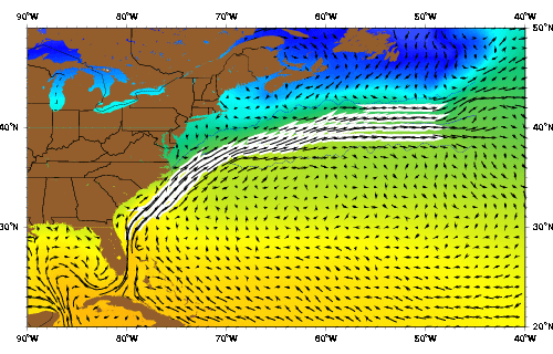
15. Does anyone have a map of wind streams and ocean currents?
Printer Friendly | Permalink |  | Top
 
Up2Late Donating Member (1000+ posts) Send PM | Profile | Ignore Sun Oct-09-05 02:34 PM
Response to Reply #15
22. Here's something, This shows Sea Tempature Anomaly (where it's too Hot)
Edited on Sun Oct-09-05 02:47 PM by Up2Late
SST Anomaly


And Sea Surface Temps


<http://www.nhc.noaa.gov/aboutsst.shtml>
Printer Friendly | Permalink |  | Top
 
Up2Late Donating Member (1000+ posts) Send PM | Profile | Ignore Sun Oct-09-05 03:03 PM
Response to Reply #22
23. Here's a similar page from NOAA, Plus, look at the W. Alaska Coast!

Click Thumbnail then October 8 on the calender


This is mainly a "El Nino" prediction sight, but you can see the Anomalies all over the world. Check out The Northern Bering Sea and Hudson Bay in Canada.
Printer Friendly | Permalink |  | Top
 
bikebloke Donating Member (1000+ posts) Send PM | Profile | Ignore Sun Oct-09-05 02:07 PM
Response to Original message
17. Hurricanes have migrated to Europe.
Years ago while working in Norway, a hurricane or what was left of one struck. Took the power out all along the fjord. Which meant my wet work clothes from the day before couldn't dry over the heater. The next day was miserable.

They've certainly struck the UK plenty of times.

I even had the same storm pass over me twice. Once in DC, then about a week later in The Nederlands.

Printer Friendly | Permalink |  | Top
 
jobycom Donating Member (1000+ posts) Send PM | Profile | Ignore Sun Oct-09-05 02:16 PM
Response to Reply #17
20. Who can blame them for wanting to, with Bush in the White House
:-)
Printer Friendly | Permalink |  | Top
 
jobycom Donating Member (1000+ posts) Send PM | Profile | Ignore Sun Oct-09-05 02:13 PM
Response to Original message
19. Weather.com says it's expected to disappear soon.
It's a small tropical storm that's about to be swallowed by a cold front.

I wonder how many of these types of storms formed in the era before satellites and were never seen. We keep talking about what a strange season this is, but we don't know what hurricane seasons were like a century ago. Unless a storm hit land somewhere, it could go undetected unless a ship wandered across it and recorded it. And who knows what hurricanes hit unpopulated areas of the Coast before 1900.
Printer Friendly | Permalink |  | Top
 
Up2Late Donating Member (1000+ posts) Send PM | Profile | Ignore Sun Oct-09-05 02:23 PM
Response to Original message
21. Here's a "SPECIAL FEATURE" report from NOAA
...SPECIAL FEATURE...

TROPICAL STORM VINCE IS NEAR 34.0N 19.2W AT 1500 UTC ABOUT 140
MILES NW OF THE MADEIRA ISLANDS MOVING NE 4 KT. MAXIMUM
SUSTAINED WINDS ARE 45 KT GUSTING TO 55 KT WITH AN ESTIMATED
MINIMUM CENTRAL PRESSURE OF 1001 MB. PLEASE REFER TO THE LATEST
NHC FORECAST/ADVISORY UNDER AWIPS/WMO HEADERS MIATCMAT3/WTNT23
KNHC FOR MORE DETAILS. VINCE IS A SMALL TROPICAL CYCLONE WITH
MODERATE CONVECTION ENCIRCLING THE CENTER WITHIN 45-60
NM...INTENSIFYING RECENTLY. AN EYE IS APPARENT ON SATELLITE
PICTURES WITH EVEN SOME HINTS OF OUTFLOW... A SLOW MOTION TO
THE NE LOOKS LIKELY AHEAD OF A COLD FRONT WHICH WILL PROBABLY
ABSORB THE SYSTEM IN A FEW DAYS. A PRELIMINARY EXAMINATION
SUGGESTS THIS IS THE FARTHEST EAST AND NORTH A TROPICAL CYCLONE
HAS EVER FORMED IN THE BASIN.


<http://www.nhc.noaa.gov/text/MIATWDAT.shtml??offshore?mtwd?text?sst?surface?danger?tropsanal?hsf>
Printer Friendly | Permalink |  | Top
 
XOKCowboy Donating Member (1000+ posts) Send PM | Profile | Ignore Sun Oct-09-05 03:11 PM
Response to Original message
24. I leave tomorrow...
after 9 days in Spain. Just in time I guess. That is freaking wierd. It's the farthest east and north of any TS that ever developed in that basin. It'll be interesting to see what becomes of it.
Printer Friendly | Permalink |  | Top
 
MissMarple Donating Member (1000+ posts) Send PM | Profile | Ignore Sun Oct-09-05 04:02 PM
Response to Reply #24
26. I visited Spain this year on vacation. It's a great place.
I hope they just get some rain out of this.
Printer Friendly | Permalink |  | Top
 
shawmut Donating Member (1000+ posts) Send PM | Profile | Ignore Sun Oct-09-05 04:28 PM
Response to Original message
29. Vince is now a hurricane
Printer Friendly | Permalink |  | Top
 
oregonindy Donating Member (790 posts) Send PM | Profile | Ignore Sun Oct-09-05 05:37 PM
Response to Reply #29
32. um....when was the last time a hurricane hit portugual?
Printer Friendly | Permalink |  | Top
 
Up2Late Donating Member (1000+ posts) Send PM | Profile | Ignore Sun Oct-09-05 10:11 PM
Response to Reply #29
34. Here's a closer view with the cities marked. Current forecast has Lisbon..
Edited on Sun Oct-09-05 10:12 PM by Up2Late
...Portugal taking a big hit. Below is the 9 hour forecast and links to the 21 hour forecast.

<http://tsr.mssl.ucl.ac.uk/tracker/dynamic/200523N_1H.html>


<http://tsr.mssl.ucl.ac.uk/tracker/dynamic/200523N.html>

<http://tsr.mssl.ucl.ac.uk/tracker/dynamic/200523N_2H.html>

<http://tsr.mssl.ucl.ac.uk/>

It's kind of aggravating how the News and the Weather Channel are downplaying the danger this storm poses to 2 countries that are most likely totally unprepared for a storm like this.
Printer Friendly | Permalink |  | Top
 
Warren DeMontague Donating Member (1000+ posts) Send PM | Profile | Ignore Sun Oct-09-05 05:28 PM
Response to Original message
31. I was more partial to tropical storm Brent
Tropical storm Keith was pretty good for a while there, too.
Printer Friendly | Permalink |  | Top
 
Up2Late Donating Member (1000+ posts) Send PM | Profile | Ignore Sun Oct-09-05 09:54 PM
Response to Reply #31
33. When were those, and where did they hit?
If you have a Year, I think I can look them up.
Printer Friendly | Permalink |  | Top
 
Warren DeMontague Donating Member (1000+ posts) Send PM | Profile | Ignore Mon Oct-10-05 12:54 AM
Response to Reply #33
35. It was a (fairly dumb) joke intended for Deadheads.
Edited on Mon Oct-10-05 12:56 AM by impeachdubya
:hippie:

And to make a serious comment re: the thread, I completely agree with you-- global warming is seriously screwing shit up.
Printer Friendly | Permalink |  | Top
 
Up2Late Donating Member (1000+ posts) Send PM | Profile | Ignore Tue Oct-11-05 12:09 AM
Response to Original message
36. Weirdest Tropical Storm Landfall EVER.
In about 3-4 hours. Still looking for News reports of this odd event.


<http://tsr.mssl.ucl.ac.uk/tracker/dynamic/200523N_0.html>

<http://tsr.mssl.ucl.ac.uk/>
Printer Friendly | Permalink |  | Top
 
DU AdBot (1000+ posts) Click to send private message to this author Click to view 
this author's profile Click to add 
this author to your buddy list Click to add 
this author to your Ignore list Thu Apr 18th 2024, 06:54 PM
Response to Original message
Advertisements [?]
 Top

Home » Discuss » Archives » General Discussion (Through 2005) Donate to DU

Powered by DCForum+ Version 1.1 Copyright 1997-2002 DCScripts.com
Software has been extensively modified by the DU administrators


Important Notices: By participating on this discussion board, visitors agree to abide by the rules outlined on our Rules page. Messages posted on the Democratic Underground Discussion Forums are the opinions of the individuals who post them, and do not necessarily represent the opinions of Democratic Underground, LLC.

Home  |  Discussion Forums  |  Journals |  Store  |  Donate

About DU  |  Contact Us  |  Privacy Policy

Got a message for Democratic Underground? Click here to send us a message.

© 2001 - 2011 Democratic Underground, LLC