Democratic Underground Latest Greatest Lobby Journals Search Options Help Login
Google

Tornadic Vortex Signature (TVS) north of Lawton, OK. Max top 65,000'.

Printer-friendly format Printer-friendly format
Printer-friendly format Email this thread to a friend
Printer-friendly format Bookmark this thread
This topic is archived.
Home » Discuss » Archives » General Discussion (1/22-2007 thru 12/14/2010) Donate to DU
 
DemoTex Donating Member (1000+ posts) Send PM | Profile | Ignore Sun May-06-07 09:41 PM
Original message
Tornadic Vortex Signature (TVS) north of Lawton, OK. Max top 65,000'.
Lower-left corner of screen.


(This picture will self-update)
Printer Friendly | Permalink |  | Top
uppityperson Donating Member (1000+ posts) Send PM | Profile | Ignore Sun May-06-07 09:44 PM
Response to Original message
1. kick for OK
Printer Friendly | Permalink |  | Top
 
DemoTex Donating Member (1000+ posts) Send PM | Profile | Ignore Sun May-06-07 09:49 PM
Response to Reply #1
2. They just dropped the TVS .. but bad shit everywhere in Toto-land.
Be careful.
Printer Friendly | Permalink |  | Top
 
kestrel91316 Donating Member (1000+ posts) Send PM | Profile | Ignore Sun May-06-07 09:55 PM
Response to Original message
3. That can't be right. The cloud tops out at 65 THOUSAND FEET?????
Printer Friendly | Permalink |  | Top
 
DemoTex Donating Member (1000+ posts) Send PM | Profile | Ignore Sun May-06-07 10:01 PM
Response to Reply #3
7. Yes. Very common now.
I guess it is better vertical measurement techniques (RADAR/GPS?). I have noticed it since finding the great WSI service in the past few months.
Printer Friendly | Permalink |  | Top
 
The Velveteen Ocelot Donating Member (1000+ posts) Send PM | Profile | Ignore Sun May-06-07 10:03 PM
Response to Reply #3
8. Yes, convective weather can reach that height -- it can go up as far
Edited on Sun May-06-07 10:15 PM by ocelot
as the tropopause (where they usually stop rising because of the temperature and dry air), and depending on latitude the tropopause starts as high as about 11 miles. It's gotta be a bad one, though.
Printer Friendly | Permalink |  | Top
 
Aviation Pro Donating Member (1000+ posts) Send PM | Profile | Ignore Sun May-06-07 10:13 PM
Response to Reply #3
12. Yes....
Edited on Sun May-06-07 10:16 PM by Aviation Pro
...severe TS (usually a squall line) can bust right through the tropopause and into the stratosphere. Unlike more common airmass TS, these monsters are fueled by a rapidly moving mass of Continental Polar Air, a moisture rich Maritime Tropical mass and a dry line that sits about mid-Texas. The vorticity created from this deadly combination and the density of the air at cloud tops causes the F3 or greater +FCs (tornadoes).

On edit, here's the latest Radar Summary chart:

Printer Friendly | Permalink |  | Top
 
DemoTex Donating Member (1000+ posts) Send PM | Profile | Ignore Sun May-06-07 10:28 PM
Response to Reply #12
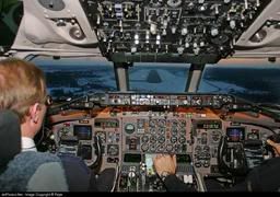
17. As a pilot, would you rather have that "map" you posted .. or my radar summary chart?
I have 17,000+ hours, 1/2 of which are in the Boeing 737 series, and I hate those "map" radar summary charts. But, then again, as a long-time aviation writer, I understand the brick-walls against getting the best weather info to the airline line pilot. It has to do with the almighty dollar.


Printer Friendly | Permalink |  | Top
 
Aviation Pro Donating Member (1000+ posts) Send PM | Profile | Ignore Sun May-06-07 10:36 PM
Response to Reply #17
18. Real time radar of course.....
...coming to an MFD near you. We're currently using XM in our fleet and it's good but there's a five minute lag. Personally I hate the fax charts and the abomination of the radar summary report is useless so if Center isn't busy I always ask.
Printer Friendly | Permalink |  | Top
 
Aviation Pro Donating Member (1000+ posts) Send PM | Profile | Ignore Sun May-06-07 10:41 PM
Response to Reply #17
20. Is that a sim or the real deal in your photo?
"Set thrust!"
Printer Friendly | Permalink |  | Top
 
DemoTex Donating Member (1000+ posts) Send PM | Profile | Ignore Sun May-06-07 10:58 PM
Response to Reply #20
21. Someone's sim
I was a US Airways MD-80 captain until 9/10/2001. Got busted by the flight doc for high oil pressure. Never got a good picture, so I garnered this from the public domain.
Printer Friendly | Permalink |  | Top
 
SheilaT Donating Member (1000+ posts) Send PM | Profile | Ignore Sun May-06-07 09:56 PM
Response to Original message
4. I'm in Overland Park, KS,
and it's been raining on and off all day. More on than off. Thunder, lightning, maybe a little hail. Not supposed to get tornadoes here from this weather system, but I'm sure it all could change.
Printer Friendly | Permalink |  | Top
 
GainesT1958 Donating Member (1000+ posts) Send PM | Profile | Ignore Sun May-06-07 09:57 PM
Response to Original message
5. They'e saying now...
That the F5 which KO'd Greensburg, Kansas, was 1.7 miles wide.

I cannot even picture what a tornado 1.7 miles in diameter would look like. I guess that width of swath and speed is why virtually the entire town was destroyed.

It's also hard to understand why that system has moved so little in the past 24 hours--it's almost as if it's stalled; at least the portion over Kansas, Oklahoma and Texas.

Meanwhile, around these parts, we've got a very late-season Nor'easter forming off of Cape Hatteras. But it's forecast to move SOUTH over the next two days, and BACK UP toward our coast while doing so. That's the most bizzare behavior for a Nor'easter I've ever seen; more like a tropical storm or a hurricane. We may have wind gusts of upwards of 50 mph over the next two days, with sustained winds of 35 mph--just 4 mph below tropical storm force.

Nice what that "hoax" of climate changes is doing to us lately, huh, Sen. Imhofe?

B-)
Printer Friendly | Permalink |  | Top
 
uppityperson Donating Member (1000+ posts) Send PM | Profile | Ignore Sun May-06-07 10:07 PM
Response to Reply #5
10. It looked like this
Printer Friendly | Permalink |  | Top
 
rasputin1952 Donating Member (1000+ posts) Send PM | Profile | Ignore Sun May-06-07 10:17 PM
Response to Reply #10
13. Holy Shit!...
I don't have much in the fear aspect of life...but THAT is scary as hell...:scared:
Printer Friendly | Permalink |  | Top
 
uppityperson Donating Member (1000+ posts) Send PM | Profile | Ignore Sun May-06-07 10:20 PM
Response to Reply #13
14. I've seen plenty of funnel clouds, several tornados, but nothing like that.
Printer Friendly | Permalink |  | Top
 
rasputin1952 Donating Member (1000+ posts) Send PM | Profile | Ignore Sun May-06-07 10:27 PM
Response to Reply #14
16. I've seen funnel clouds, but have missed any that have
touched down. I'm in NE Nebraska, and we just got out of a tornado warning. If I saw something like that coming at me...let's just say, if I survived, I'd definately go to the hospital w/unclean underwear!

I guess my dear old mom would be mortified...:)
Printer Friendly | Permalink |  | Top
 
lovuian Donating Member (1000+ posts) Send PM | Profile | Ignore Sun May-06-07 11:42 PM
Response to Reply #5
23. I just deleted a Repub comment on You Tube because he
started giving me crap about how Global Warming was a scam

Dude look at the freakin RADAR

these people are braindead

I'm lost for words I just delete them
Printer Friendly | Permalink |  | Top
 
madrchsod Donating Member (1000+ posts) Send PM | Profile | Ignore Sun May-06-07 09:58 PM
Response to Original message
6. been watching these storms all day.
they make it to eastern iowa and as soon as they hit the mississippi river along the northern illinois and iowa border they dissipate. not a drop of rain in northern illinois yet the storm tracks indicate we should getting slammed. hell i had to water some of my plants because the ground is dry...
Printer Friendly | Permalink |  | Top
 
DemoTex Donating Member (1000+ posts) Send PM | Profile | Ignore Sun May-06-07 10:05 PM
Response to Reply #6
9. The talking heads say the line will move very slowly .
The low is a creeper, evidently. Not good for the mid-west.
Printer Friendly | Permalink |  | Top
 
whoneedstickets Donating Member (1000+ posts) Send PM | Profile | Ignore Sun May-06-07 11:01 PM
Response to Reply #9
22. Drove from Omaha to Minneapolis today...
..Western Iowa is really soaked. Most of the streams passing under the highway were over their banks and nearly bridge height. Huge areas of standing water in the fields. That can't be good for the new corn crop.
Printer Friendly | Permalink |  | Top
 
rasputin1952 Donating Member (1000+ posts) Send PM | Profile | Ignore Sun May-06-07 10:12 PM
Response to Original message
11. 65000 ft converts to 12.31 MILES!!! Holy crap!
This is wild...:crazy:
Printer Friendly | Permalink |  | Top
 
tandot Donating Member (1000+ posts) Send PM | Profile | Ignore Sun May-06-07 10:23 PM
Response to Original message
15. Shit. My sister lives NE of Oklahoma City.
:scared:
Printer Friendly | Permalink |  | Top
 
Strelnikov_ Donating Member (1000+ posts) Send PM | Profile | Ignore Sun May-06-07 10:40 PM
Response to Original message
19. ...Widespread Flooding and Historic River Crests Expected...
Time to get out the waders.

http://www.crh.noaa.gov/crnews/display_story.php?wfo=eax&storyid=7825&source=0

A weather pattern not observed since the Great Flood of 1993 appears to be taking shape over the Lower Missouri River Valley region today. The graphic below depicts the current weather pattern which favors a setup for a four to five day period of persistent, heavy rainfall. A strong upper level storm system will remain locked across the Southern Rockies for much of the week, allowing deep tropical moisture to stream northward. A stationary surface front, draped across southern Kansas and Missouri, will serve as the focus for repeated thunderstorm development. Several thunderstorm complexes are expected to develop from today, possibly continuing through Friday. Three to five inches of rain has already fallen since midnight Sunday across much of northwest Missouri and adjacent eastern Kansas. An additional three to five inches of rain, with locally higher amounts, is expected to fall over the course of the next several days.

With soils already saturated, and streams/creeks/rivers already swelled from recent rains, flash flooding will become and extremely dangerous and potentially life threatening situation. The excessive rainfall will lead to rapid rises along area rivers with widespread river flooding expected. In fact, current forecasts suggest that historic flood crests will occur on several rivers across northern Missouri, breaking previous high water marks set in 1993.


Printer Friendly | Permalink |  | Top
 
DU AdBot (1000+ posts) Click to send private message to this author Click to view 
this author's profile Click to add 
this author to your buddy list Click to add 
this author to your Ignore list Thu Apr 25th 2024, 03:40 PM
Response to Original message
Advertisements [?]
 Top

Home » Discuss » Archives » General Discussion (1/22-2007 thru 12/14/2010) Donate to DU

Powered by DCForum+ Version 1.1 Copyright 1997-2002 DCScripts.com
Software has been extensively modified by the DU administrators


Important Notices: By participating on this discussion board, visitors agree to abide by the rules outlined on our Rules page. Messages posted on the Democratic Underground Discussion Forums are the opinions of the individuals who post them, and do not necessarily represent the opinions of Democratic Underground, LLC.

Home  |  Discussion Forums  |  Journals |  Store  |  Donate

About DU  |  Contact Us  |  Privacy Policy

Got a message for Democratic Underground? Click here to send us a message.

© 2001 - 2011 Democratic Underground, LLC