Photography
Related: About this forumHow green was my valley. YESTERDAY
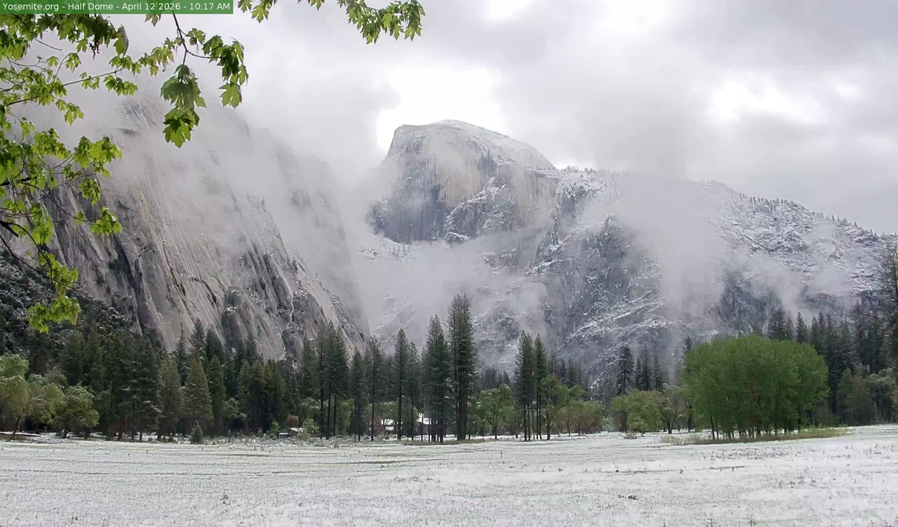
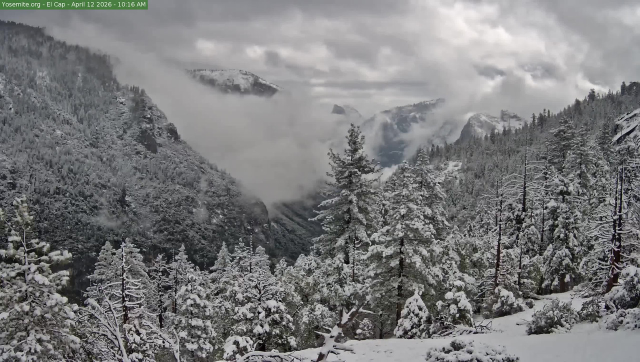
Overnight Fluff attack!
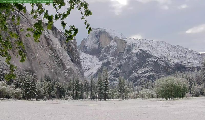
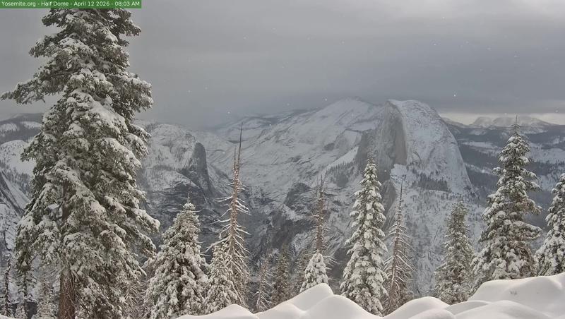
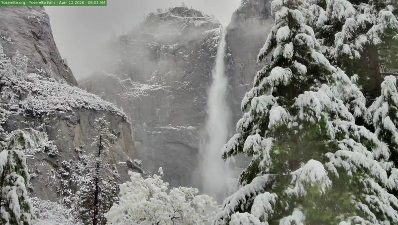
Yosemite webcams courtesy of Yosemite Conservancy, https://yosemite.org
 = new reply since forum marked as read
Highlight:
NoneDon't highlight anything
5 newestHighlight 5 most recent replies
= new reply since forum marked as read
Highlight:
NoneDon't highlight anything
5 newestHighlight 5 most recent replies

George McGovern
(12,257 posts)Neat photos. Thanks.

usonian
(25,723 posts)Valley floor is 4000 feet above sea level.
Half Dome 8846 feet above sea level.
There's a hike from the floor to Glacier Point.
https://yosemitegear.com/2024/12/hiking-to-glacier-point-from-yosemite-valley/
Hiking to Glacier Point from Yosemite Valley: A Journey Through Nature’s Masterpiece
If you’re seeking an unforgettable hiking experience in Yosemite National Park, the trek from Yosemite Valley to Glacier Point is an iconic adventure that showcases the park’s breathtaking beauty. This challenging yet rewarding hike offers stunning views, diverse landscapes, and a deep connection to the natural wonders of the Sierra Nevada. Whether you’re a seasoned hiker or an ambitious adventurer, this journey is worth every step.
Trail Options:
Four-Mile Trail
Distance: 9.6 miles round trip (4.8 miles one way)
Elevation Gain: Approximately 3,200 feet
Difficulty: Strenuous
Trailhead: Southside Drive in Yosemite Valley
and a much longer Panorama Trail (at the link)
You go! I'll loan you my camera.
I loaned my daughter my camera when it felt like the smart thing to do halfway up Sentinel Dome.
Maybe next time, I'll being a hiking stick and oxygen.
That and Taft Point when Glacier Point Road opens.
Meanwhile (any time) check the webcams.
Ever-changing
George McGovern
(12,257 posts)
surfered
(13,677 posts)usonian
(25,723 posts)Springtime fun.

Easterncedar
(6,350 posts)It's good to be reminded how much beauty there is on this troubled world