Australia's Rivers And Waterways Keep The Outback Alive: By 2070, They'll Be Unrecognizable
EDIT
 ?ixlib=rb-1.1.0&q=45&auto=format&w=754&fit=clip
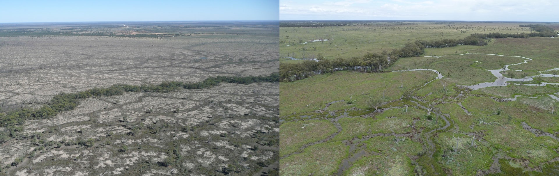
The Macquarie River in dry (2008) and wet (2010) conditions. Tim Ralph, Author provided
The physical structure of a river depends on how much water flows through it, and the sediment that water carries. Reductions in water flow – as expected due to climate change – can lead to a build-up of sediment downstream. In extreme cases, this “silting up” can cause complete disintegration of river channels, where water flows out across the floodplain.
Not all rivers are alike, and the rivers of the Murray-Darling and Lake Eyre basins (covering 1.8 million square kilometres) are particularly diverse. Many of these rivers and wetlands are internationally recognised for their hydrological and ecological importance. They range from large meandering rivers swollen by seasonal spring flows (the Upper Murray, Mitta Mitta, Kiewa, and Ovens rivers), to rivers that progressively get smaller until they become exhausted on flat, wide floodplains and disintegrate into large, boom-and-bust wetlands (the Lachlan, Macquarie, and Gwydir rivers).
 ?ixlib=rb-1.1.0&q=45&auto=format&w=754&fit=clip
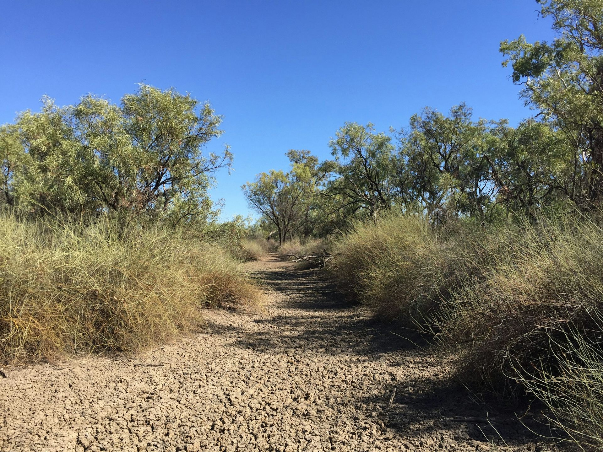
Dry channel of the lower Warrego River, northwest NSW. Author provided
In the drier areas of central Australia, rivers typically persist as a string of isolated waterholes for years at a time, occasionally punctuated by very large floods (Warrego, Paroo, Diamantina, and Cooper Creek). For Australia’s inland rivers, the average dryness, or “aridity”, of the catchment is the best predictor of what the overall structure and function of the rivers within look like. Compiling a range of climatic data, we modelled aridity for the Australian continent in 2070 under a relatively moderate climate change scenario.
The results are sobering. Over the next 50 years, the arid zone – containing the areas of true desert – is projected to expand well into the Murray-Darling Basin and almost entirely envelope the Lake Eyre Basin.
 ?1587354666
At the same time, the humid and dry subhumid fringes around the Great Dividing Range and coastal areas are expected to contract. This is concerning because the relatively wet western slopes of the Great Dividing Range are where many inland Australian rivers begin, with most of their water sourced in these smaller sub-catchments.
EDIT
https://theconversation.com/australias-inland-rivers-are-the-pulse-of-the-outback-by-2070-theyll-be-unrecognisable-136492