Environment & Energy
Related: About this forumFast-Rising Seas Demand New Flood Plans and Smart Zoning
http://www.bloomberg.com/news/2012-08-06/fast-rising-seas-demand-new-flood-plans-and-smart-zoning.htmlA new analysis of worldwide temperatures over the past 60 years has found more evidence that global warming is already upon us, and is responsible for extreme heat waves -- such as the ones in Russia in 2010 and in Texas and Oklahoma last year.
Naturally, this refocuses attention on the current U.S. drought. Left out of the discussion, however, is another, equally serious and already pressing consequence of human- induced climate change: sea-level rise. On all coasts, we face a huge and building threat from too much water.
With oceans expanding from the heat and with glaciers large and small melting away, sea levels have climbed more than 8 inches since 1880, and the current rate is about an inch and a quarter every decade. Many scientists expect the water to rise at least 2 feet to 3 feet more by the end of this century.
This won’t happen evenly everywhere. One hot spot is the East Coast of the U.S., where the land is sinking and nearby ocean currents are slowing, causing the water to rise faster. From Cape Hatteras, North Carolina, up through Cape Cod, Massachusetts, in the past half century, the speed of increase in water level has been three to four times the global average. Yet the North Carolina Legislature has essentially banned relevant state agencies from taking projections of accelerating sea-level rises into account in policy making.
 = new reply since forum marked as read
Highlight:
NoneDon't highlight anything
5 newestHighlight 5 most recent replies
= new reply since forum marked as read
Highlight:
NoneDon't highlight anything
5 newestHighlight 5 most recent replies
happyslug
(14,779 posts)More on Sea Level Rise:
http://en.wikipedia.org/wiki/File:Recent_Sea_Level_Rise.png
Some areas are rising faster then others, for example the middle Atlantic, this is tied in with the slowing of the Gulf Stream due to Greenland Ice Sheet melt, NOT any increase in actual amount of water in the sea:
http://articles.latimes.com/2012/jun/25/nation/la-na-nn-sea-level-atlantic-20120625
http://news.nationalgeographic.com/news/2012/06/120625-sea-level-rise-east-coast-us-science-nature-climate-change/
This is seen even in NOAA report on Sea level Rise, higher in the Atlantic, but dropping in Guatemala, Carney Islands, Peru, Ecuador, Argentina, Greece and New Guinea (All are areas that were NOT covered by Ice Sheets during the last Ice Age, so should be stable, but all are also are on plates edges which the above report also avoided). In areas NOT on plate edges OR subject to post glacial rebound the increase looks like about 8 inches since 1880, but most data is only from 1900 or later.
Here is a map where you can project what areas of the world will be under water at various increase in sea levels. It starts are present level, but the default is 7 meters, which is the expected world wide sea level raise if the West Antarctic Ice Sheet (WAIS) ever collapses (Which is the REAL possibility in any Late March of each year, when the Antarctic Ice Shelf is at its lowest level. The Map goes up to 60 meters, which is if the ever larger East Antarctic Ice Sheet (EAIS) ever melts. While the WAIS is unstable and has been unstable for 10,000 years (i.e. subject to a rapid, almost overnight collapse), the Greenland Ice Sheet and the EAIS are considered stable, subject to melting but not a collapse, i.e. slow but steady increase in world wide sea levels over 100 or more years (And in most Global Warming Computer simulation programs, the EAIS is expected to EXPAND under Global warming, even as the WAIS collapses. i.e. expand due to greater snowfalls due to warmer air's ability to carry more moisture. THE EAIS could expand for 50 years, then go into a slow terminal collapse).
Report on one possibility if the WAIS would collapse:
http://www.imaja.com/as/environment/can/journal/madhousecentury.html
More on the Mini-Ice Age:
http://en.wikipedia.org/wiki/Little_Ice_Age
The "next Ice Age":
http://discovermagazine.com/2002/sep/cover
Ocean Currents in the Arctic
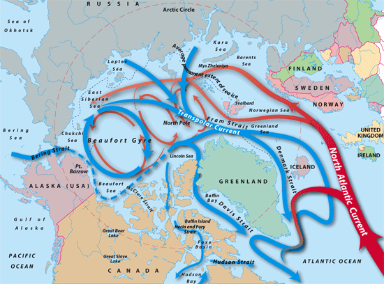
http://www.whoi.edu/page.do?pid=12455&tid=282&cid=9206
More on the Younger Dryas event (10,700 to 9500 BC):
http://en.wikipedia.org/wiki/Younger_Dryas
More on Ice Sheet Melting:
http://www.usgs.gov/newsroom/article.asp?ID=2409#.UCEqNfZmQwM
http://www.nasa.gov/topics/earth/features/20100108_Is_Antarctica_Melting.html
http://www.csr.utexas.edu/grace/gallery/animations/ice/
Reports on the Pine Island Glacier, considered the Key to the WAIS:
http://www.the-cryosphere.net/3/125/2009/tc-3-125-2009.pdf
http://www.realclimate.org/index.php/archives/2009/11/is-pine-island-glacier-the-weak-underbelly-of-the-west-antarctic-ice-sheet
http://glacierchange.wordpress.com/2009/11/12/pine-island-glacier-grounding-line/
http://www.newscientist.com/article/dn18383-major-antarctic-glacier-is-past-its-tipping-point.html