Science
Related: About this forumImage: Heart of the Atacama from orbit
Image: Heart of the Atacama from orbit
Feb 14, 2014

Credit: JAXA/ESA
This satellite image shows the heart-shaped Miscanti lake and smaller
Miñiques lake in northern Chile.
The lakewater is brackish – meaning that it's saltier than freshwater, but not as much as seawater. This is due to the salinity in the soil. Chile's largest salt flat – the Salar de Atacama – lies to the west (not pictured).
Two partially snow-covered volcanoes can be seen above and below the lakes on the right, while plains stretch out to the west in a nearly vegetation-free environment.
The area pictured is part of the Atacama Desert, which runs along part of South America's central west coast. It is considered one of the driest places on Earth, as moisture from the Amazon Basin is blocked by the Andes to the east, as well as from the Pacific Ocean by the Chilean Coastal Range to the west. Pacific Ocean currents and wind circulation also play a major role in the desert climate.
Because of the Atacama plateau's high altitude, low cloud cover and lack of light pollution, it is one of the best places in the world to conduct astronomical observations and home to two major observatories.
More:
http://phys.org/news/2014-02-image-heart-atacama-orbit.html#jCp
Telescopes at three observatories in the desert will be looking right back!
[center] 


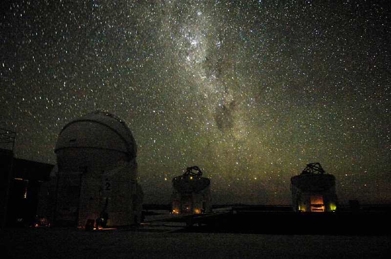
above images from the Cerro Chajnantor Atacama Telescope - ALMA
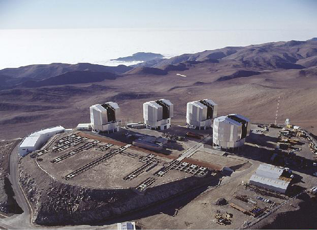

Paranal


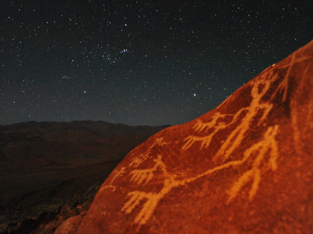
(Ancient petroglyphs on side of a La Silla mountain)
La Silla[/center]
Older article, from 2007:
August 13, 2007
Chile's Atacama Desert -World's Space-Observatory Mecca
The lunar landscapes of Chile's Atacama Desert, which stretches for about 650 miles along the Pacific Ocean to the Peruvian Border, is generally considered the driest place on earth, wedged between the rain shadows of the Andes to the east and the coast ranges to the west, while the cold Humboldt Current off the coast suppresses evaporation from the ocean. There are places in the Atacama where there has been no recorded or observed rainfall in the 400+ years since the Spaniards first arrived.
The Atacama Desert's dry climate and 5,600-meter (about 3.5 miles) altitude make it a unique and ideal mecca for both ground-based reflector and far-infrared astronomy. The southern hemisphere skies were opened with the construction of the Carnegie 100-inch DuPont telescope at Las Campanas in 1977.
Ccat Thirty years later, Cornell and Caltech have announced the "Atacama Telescope Project To Revolutionize Astronomy," a proposed 25-meter aperture telescope that will be the largest, most precise and highest astronomical facility in the world.
The $100 million Cornell Caltech telescope, to be built in the Cerro Chajnantor in the Atacama Desert region in Chile, will take advantage of the rapid development in bolometer array technology (instruments that measures radiant energy) to answer some of the most fundamental questions of cosmology. Radiation at submillimeter wavelengths (longer than visible light but shorter than radio waves) is normally difficult to detect from the ground because it is easily absorbed by water in the Earth's atmosphere. Situating the telescope in the dry Atacama Desert eliminates this problem.
More:
http://www.dailygalaxy.com/my_weblog/2007/08/the-driest-plac.html
 = new reply since forum marked as read
Highlight:
NoneDon't highlight anything
5 newestHighlight 5 most recent replies
= new reply since forum marked as read
Highlight:
NoneDon't highlight anything
5 newestHighlight 5 most recent replies
Scootaloo
(25,699 posts)But pictures like this:
certainly stir that sort of feeling in me. I'm a staunch atheist who thinks the Hubble deep fields are like looking at the face of god.
Sooo... thanks for these 

Cleita
(75,480 posts)I used to live close to there. There is a river too that flows through there too in a U shape, the Rio Loa, also salty because that whole area was once under an ancient ocean. When I was a child we found fossils of shells and and sea rocks at eleven thousand feet elevation.

Judi Lynn
(160,527 posts)you've had, from the Atacama Desert.
It would seem impossible to ever forget it.
It also seems impossible to understand how that region could have ever been resting under a great ocean at one time. Overwhelming!
Simply mind boggling, imagining finding shell fossils there, too.
So much mystery, so much darkness, we gotta struggle toward enlightenment, as elusive as it seems.
Thank you for your comments.

cantbeserious
(13,039 posts)eom